


NORTHEAST GEORGIA — Widespread thunderstorms are expected across Northeast Georgia Monday afternoon and evening, bringing the threat of heavy rain, localized flash flooding, damaging wind gusts, and frequent lightning.
The National Weather Service has placed much of Northeast Georgia under a Level 2 of 4 Slight Risk for Excessive Rainfall. Rainfall totals of 2 to 3 inches are possible, with isolated higher amounts where storms repeatedly move over the same locations.
Flash flooding threat; damaging winds
According to White County Public Safety Division Chief Don Strength, the greatest concern is heavy rainfall that could quickly cause flash flooding. A few storms could also become strong to severe, producing wind gusts up to 60 mph capable of downing trees and power lines.
Strength said flooding is most likely in poor-drainage areas, low-lying locations, and places that receive multiple rounds of heavy rain. He encourages residents to monitor weather conditions throughout the afternoon and evening, especially if they have outdoor activities, travel plans, or scheduled events.
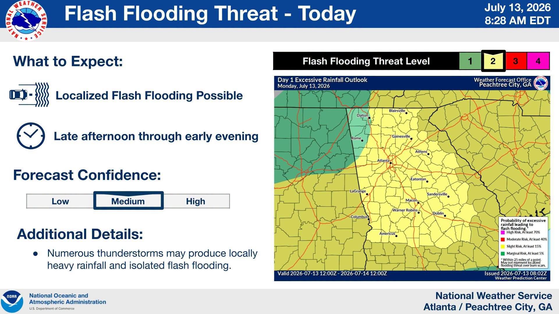
Drivers should use extra caution during heavy downpours. Roads can flood quickly, and officials remind motorists never to drive through water-covered roadways.
The unsettled pattern will continue into Tuesday, when numerous to widespread thunderstorms are again expected. Those storms will also be capable of producing gusty winds, frequent lightning, and locally heavy rainfall before a more typical summertime pattern returns later in the week.
WRWH Radio’s Dean Dyer contributed to this report
SEE ALSO
Don’t miss what everyone in town is talking about.
Join 4,000+ locals and choose our free newsletter covering news, events and the stories shaping our region.