


A very hot, moist airmass will lead to scattered afternoon storm development. With high temps, these storms will have plenty of fuel to become severe and produce damaging winds.
The Storm Prediction Center has all of North Georgia under a marginal (level 1/5) risk for severe storms with the extreme northern tier under a slight (level 2/5) risk on Monday afternoon.
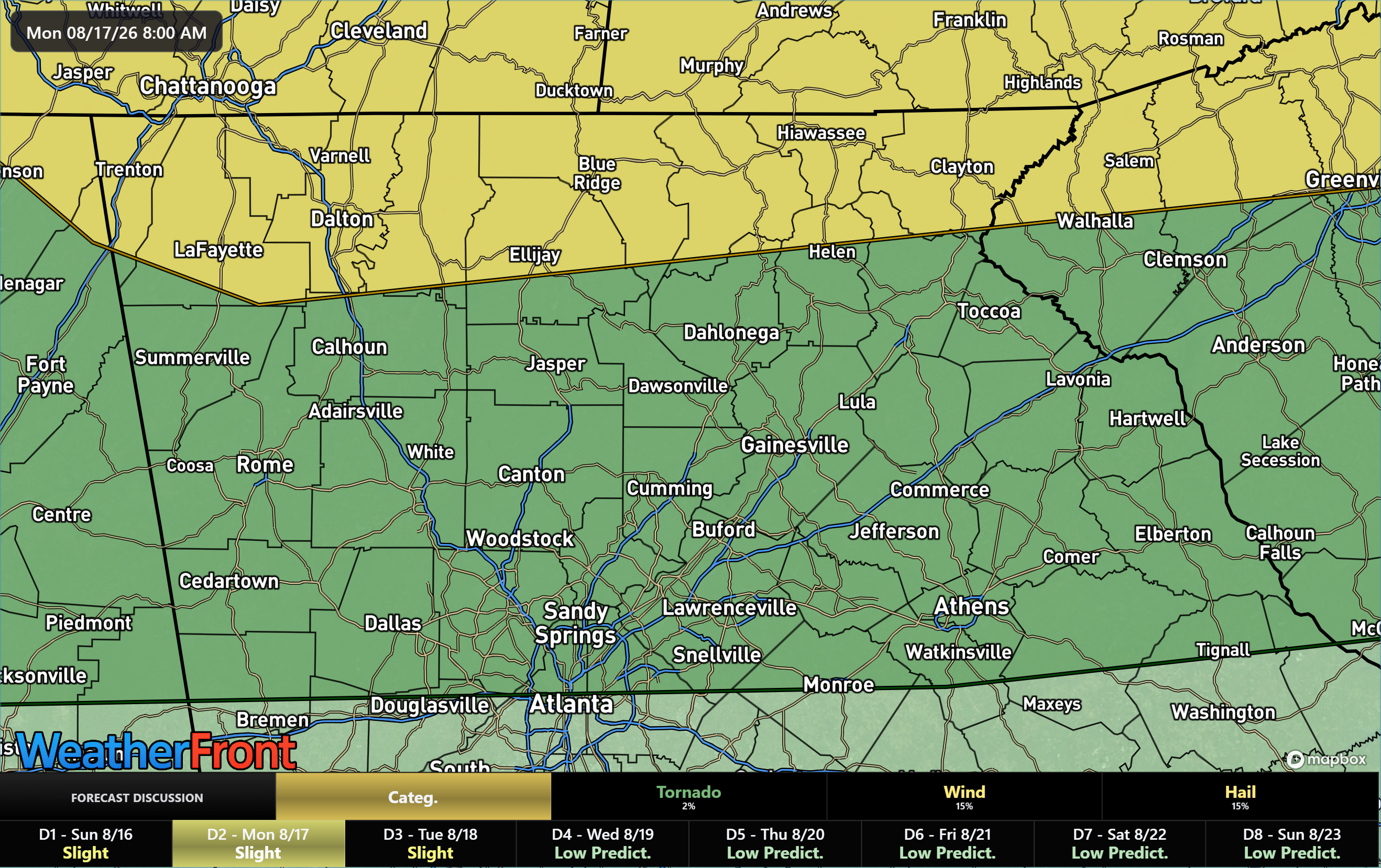
The main risk will be damaging winds as these storms will have access to a very hot, very moist airmass. Afternoon highs will be as hot as they’ve been all summer in the upper-90s outside the mountains and upper-80s even into the higher elevations.
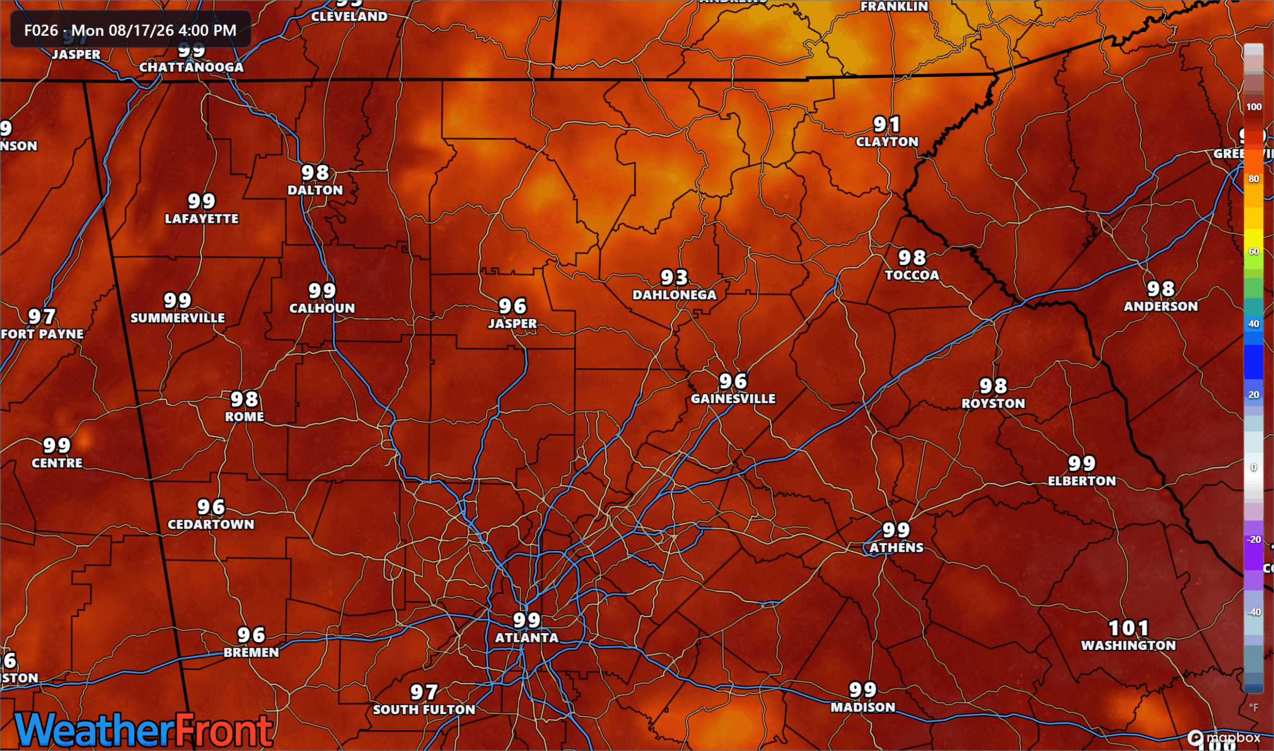
This will result in isolated to scattered storm development across the region from late afternoon into the early overnight hours.
Damaging winds and torrential rain will be the largest threats, along with frequent lightning. Some small hail is also possible, but the threat level is fairly low. The output from the HRRR model shows the potential for these wind gusts with these storms during the evening/early overnight hours. Don’t take this verbatim, models will never nail exact storm locations of pop-up cells, but the general potential is certainly there. Storms will be moving west to east across the region.
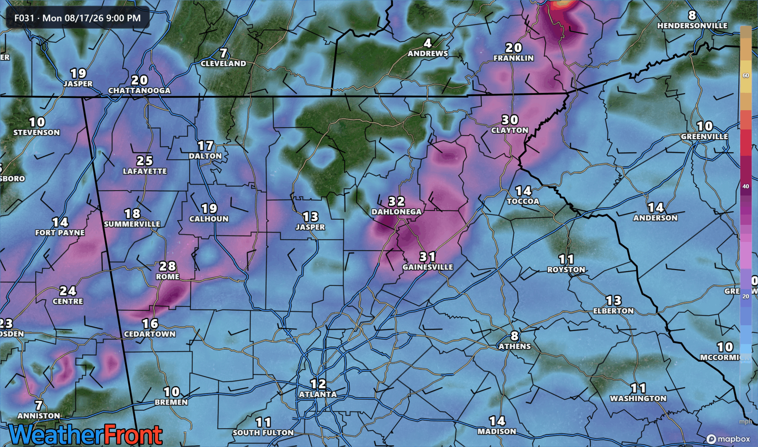
Stay weather aware Monday evening into the overnight hours.
Don’t miss what everyone in town is talking about.
Join 4,000+ locals and choose our free newsletter covering news, events and the stories shaping our region.