

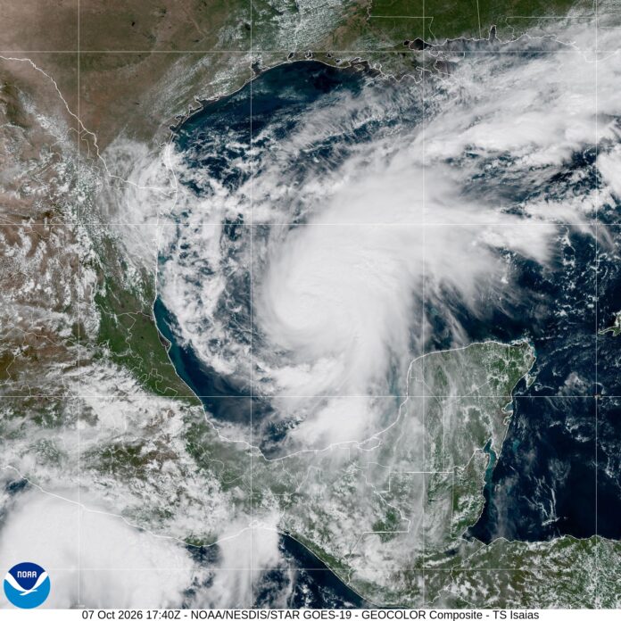
Tropical Storm Isaias has continued to quickly strengthen in the southern Gulf today.
As of 5 p.m. Oct. 7, the storm contained winds of 65 m.p.h. with higher gusts. Hurricane hunter aircraft have been monitoring the storm all morning and will continue to do so through the afternoon and overnight. The storm is moving slowly ENE at 8 m.p.h., and is expected to become a hurricane overnight Wednesday night. Satellite presentation has continued to improve today with the classic “comma” shape seen in many developing strong storms, although some dry air has been evident on the western side of the circulation.
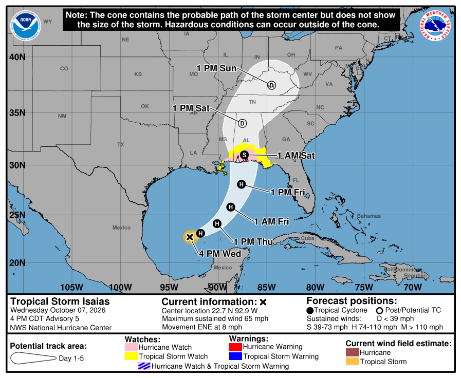
Eventually the east northeast track will turn more north, and models have continued to hone in on the Mississippi/Alabama/West Florida region for landfall on Saturday morning. A Hurricane Watch is in effect from roughly Gulfport, MS to Apalachicola, FL where a storm surge of 5-7ft is forecast along with the potential for hurricane force winds.
The storm is quite small and compact, but it will grow in size as it approaches landfall and after a peak likely in the strong Category 1 to mid Category 2 range a weakening trend just before landfall seems likely. After landfall the storm is expected to move inland due north, with the potential for a turn back to the northwest as it is absorbed by an approaching cold front.
For Georgia, a further east track at landfall means more significant impacts as the core of the storm moves inland just to our west on the current track. This would place the entire state on the strongest side of the storm, bringing a risk for gusty winds, flooding and isolated tornadoes. The forecast radar below from the most recent GFS shows this potential with a stronger storm and further east landfall.
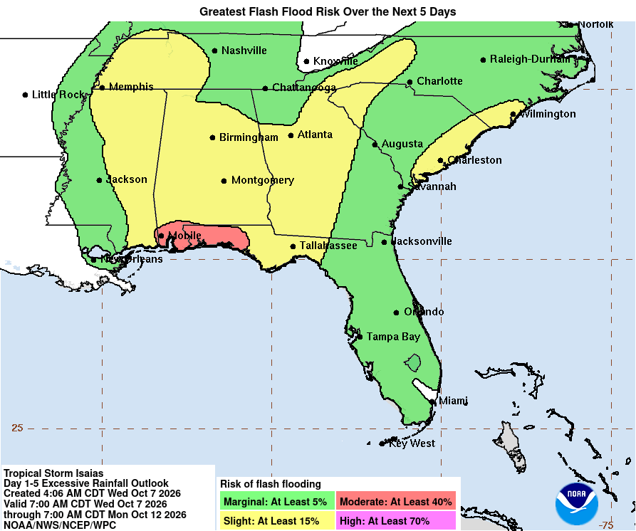
The Weather Prediction Center has adjusted their map a tad, but most of Northeast Georgia remains under a slight (level 2/4) risk for flash flooding. Additional adjustments to this map are highly likely as the track is refined.
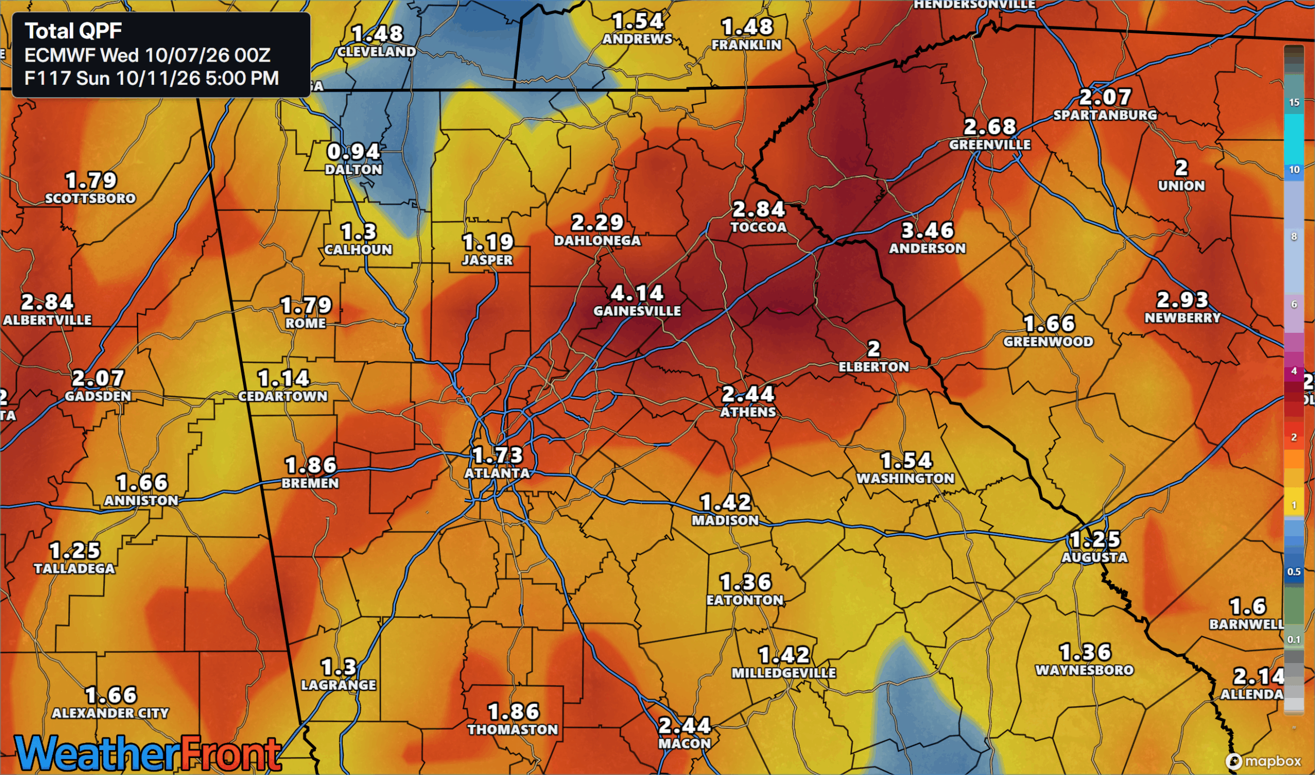
Total rainfall amounts are currently tracking in the 1-3″ range with isolated higher amounts possible. This rain will mostly fall in very quick order from late Saturday through mid-day Sunday.
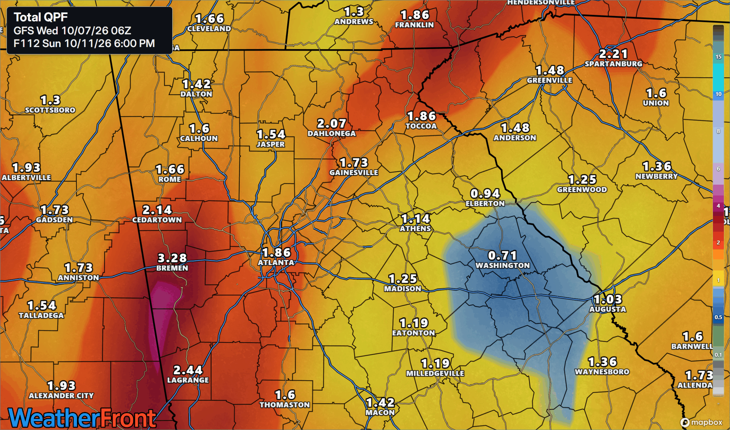
Winds are a big question mark with this storm, with most modeling keeps surface winds in the 20-30 m.p.h. range at most but higher gusts will certainly be possible- especially if Isaias makes landfall stronger. Regardless of surface winds, strong winds will definitely be ongoing just above the surface and a risk for isolated tornadoes is expected. The highest risk for tornadoes currently appears to be over West and Northwest Georgia, although there is a risk state-wide.
We’ll be tracking Isaias throughout the day today and the coming days, so stay tuned and stay weather aware going into this weekend.
Don’t miss what everyone in town is talking about.
Join 4,000+ locals and choose our free newsletter covering news, events and the stories shaping our region.