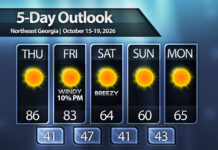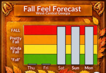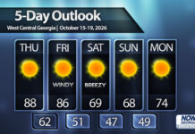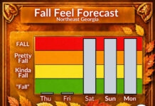

It’s mid-October, which means our average highs are generally in the low/mid-70s across the region. Unfortunately, a late season heat wave will have us well above those numbers on Thursday.
Record highs on the way
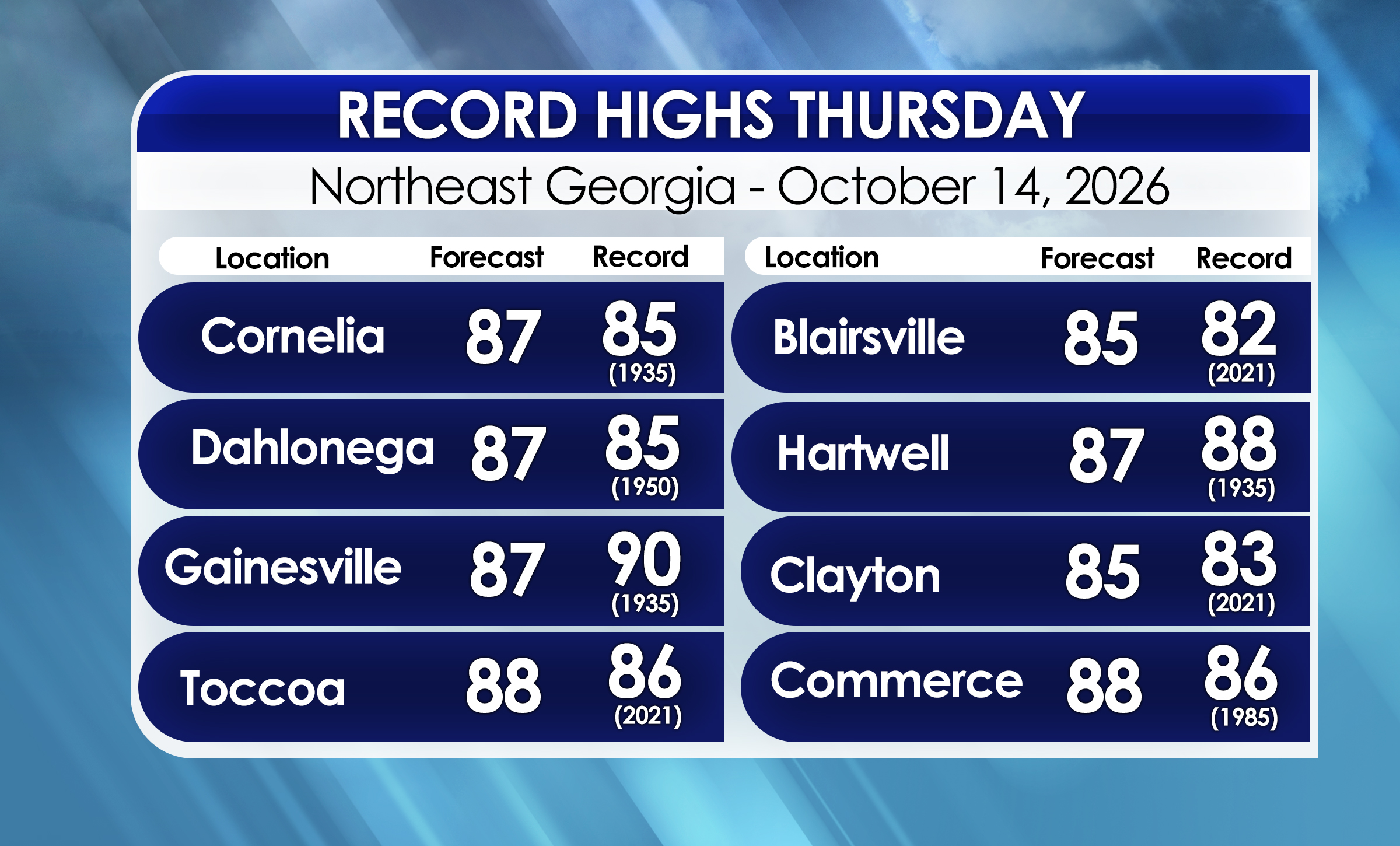
Forecast highs on Thursday are expected to reach well into the 80s in all but the highest elevations of the mountains. Record highs will once again be in jeopardy.
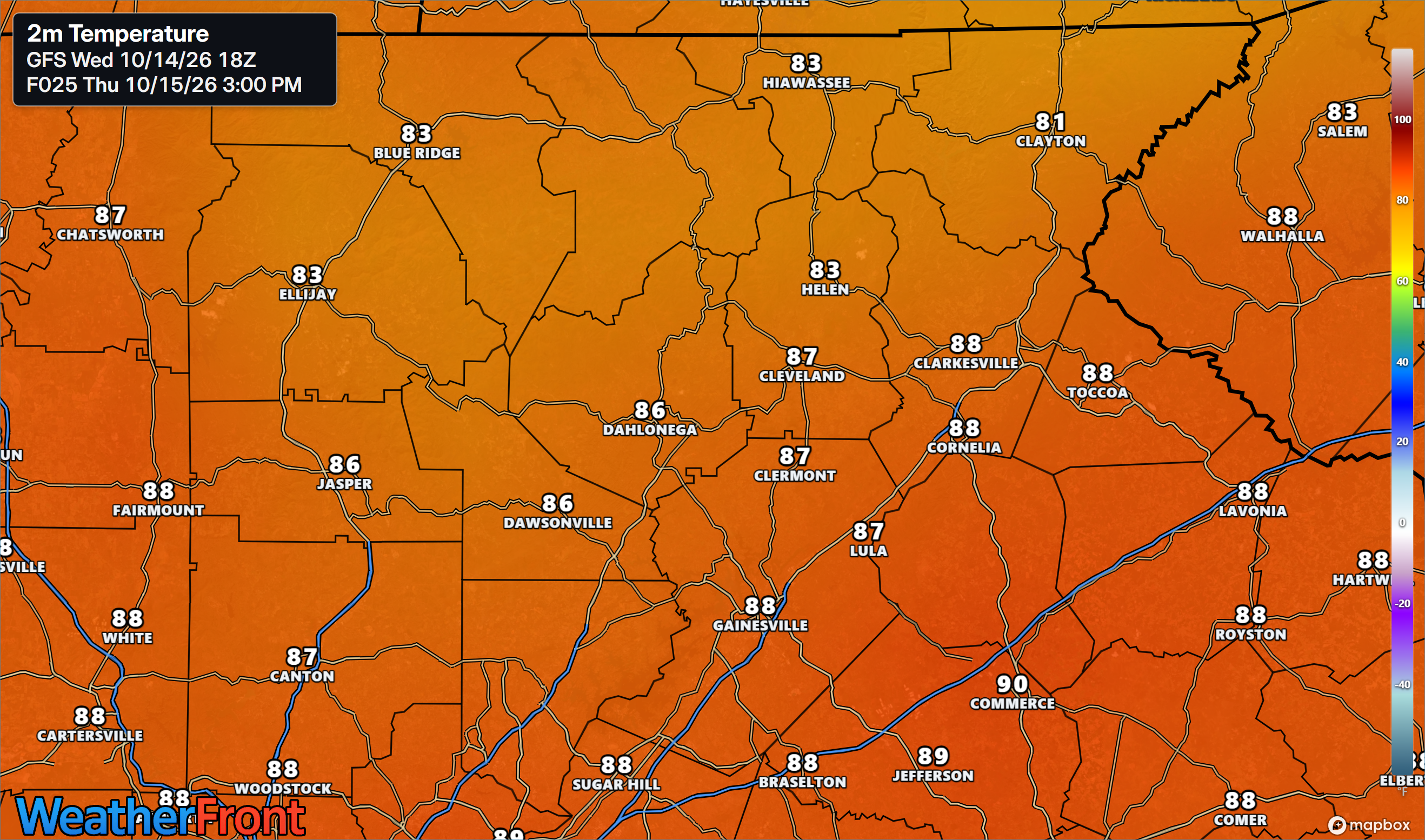
Highs are expected to range from the low/mid-80s around Blairsville and Clayton to the upper-80s in Gainesville, Cornelia, and other locations in the foothills. You can see how this stacks up against records below. Many records are likely to fall, with only Gainesville and Hartwell being relatively safe.
Major front, strong winds Friday
The good news about all this temperatures are expected to go into freefall mode on Friday. Afternoon highs Friday will still reach the low/mid-80s ahead of a strong front, but starting late afternoon or early evening winds will quickly pick up and temperatures will fall quickly.
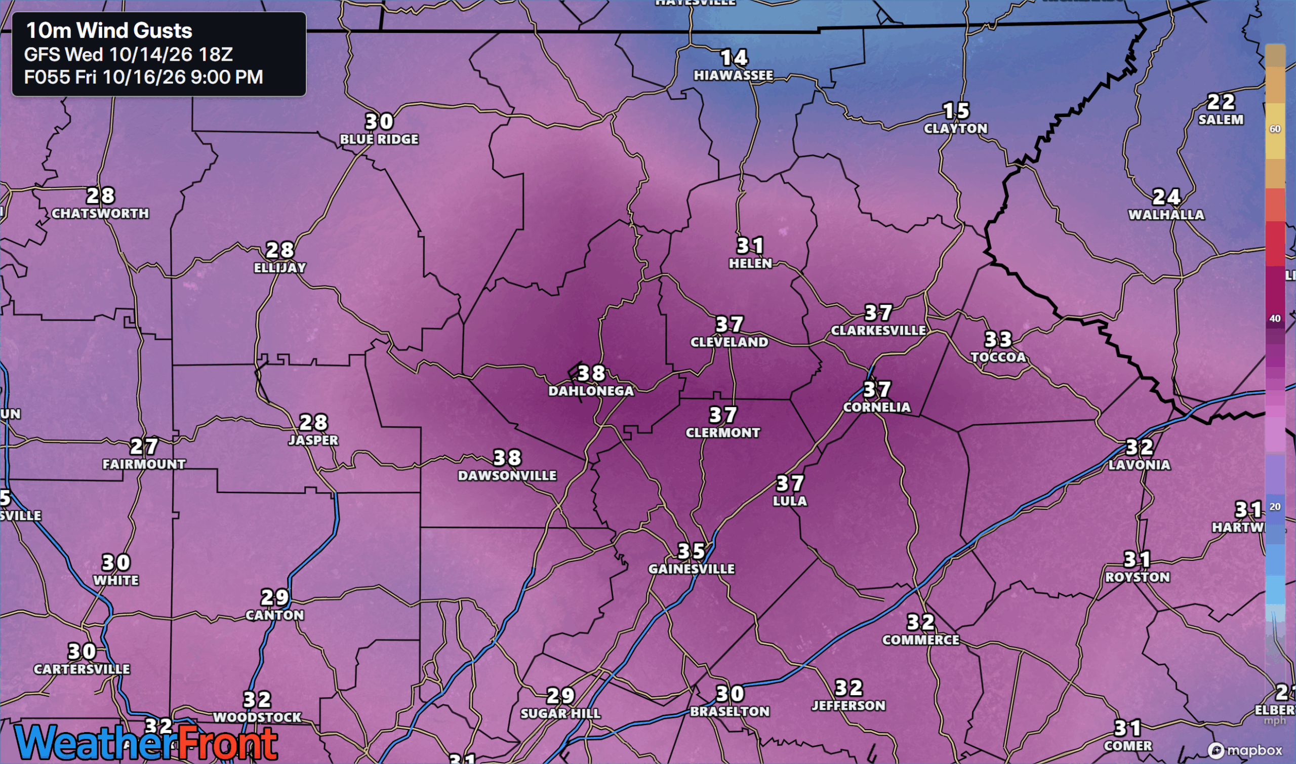
Behind the front winds will briefly turn very gusty on Friday evening. The image below shows potential gusts from the latest modeling Friday evening. Exact timing of the strongest winds varies by a few hours between the models, but a brief period of widespread 30-35 m.p.h. gusts are possible on the downwind side of the higher elevations. Winds could briefly gust to 40 m.p.h. at the higher elevations. These gusts will be pretty short lived and occur as temperatures make their first 20º drop of a total 40º drop expected overnight.
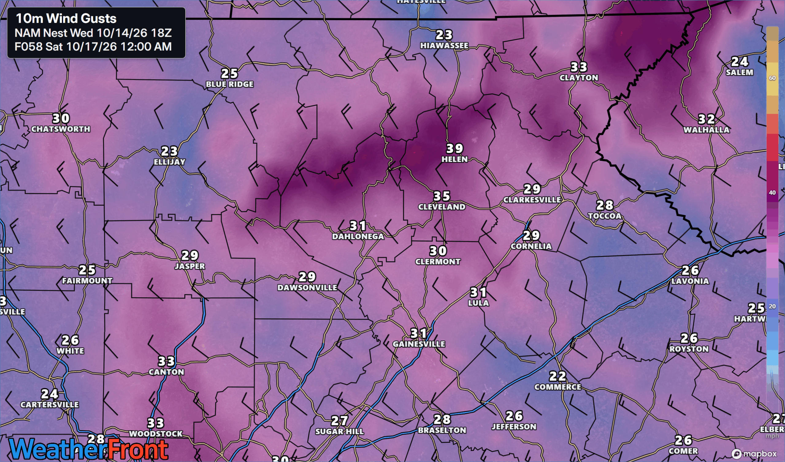
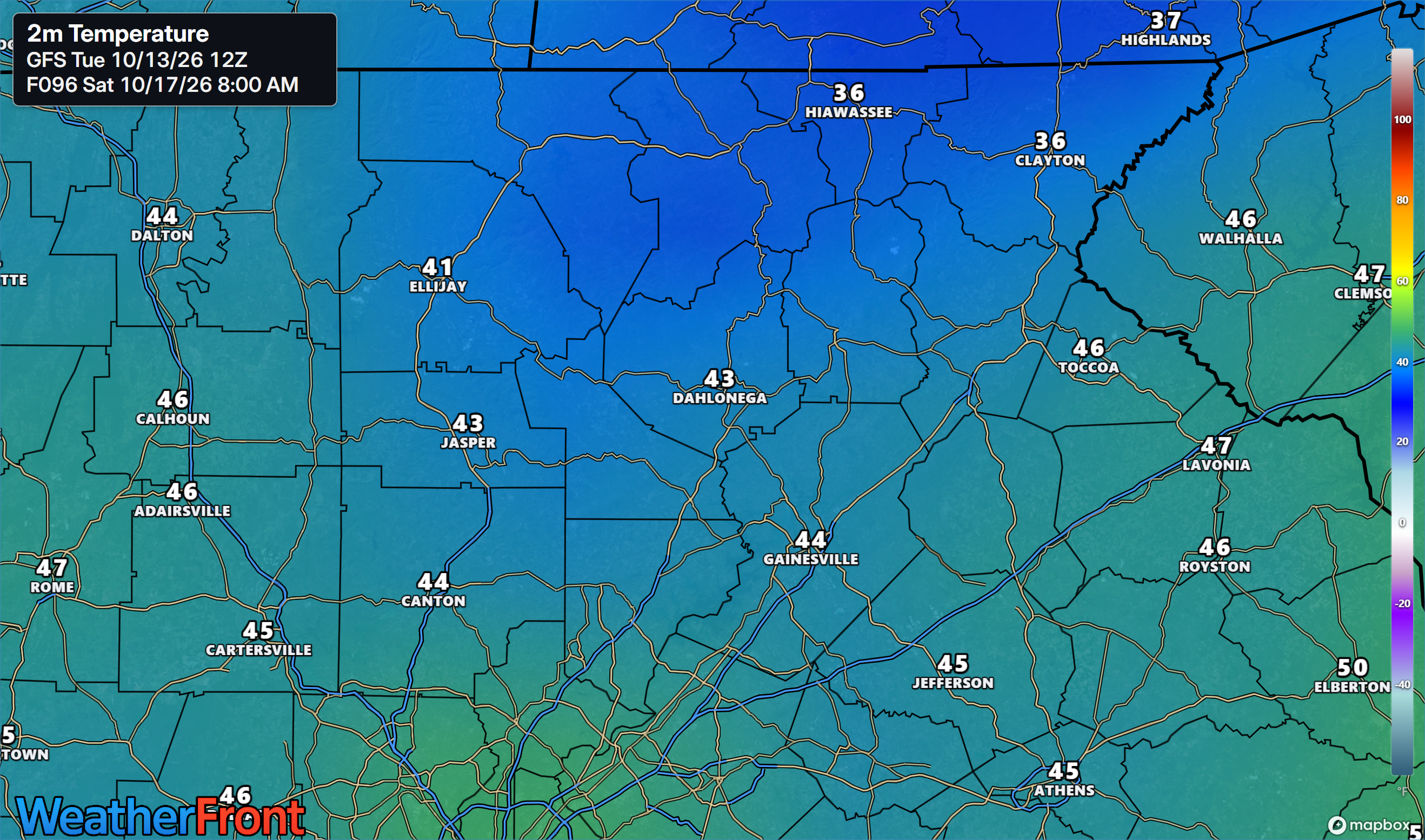
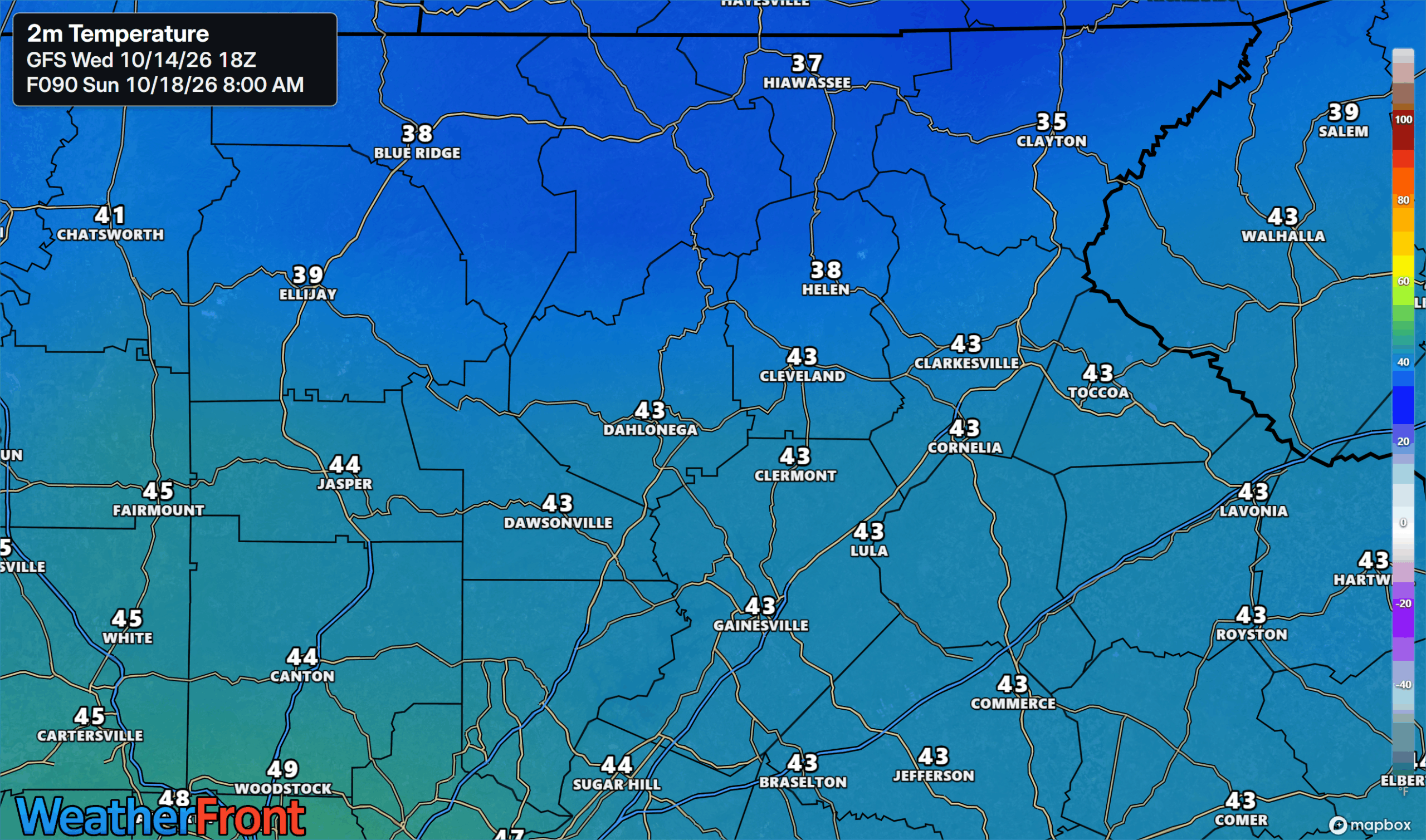
By Saturday morning, temperatures will have fallen 40+º from Friday afternoon highs. Widespread upper-30s are likely in the mountains with low-40s elsewhere. The winds will keep any frost concerns away for Friday night, but Saturday night we will likely see our first frost threat across the mountains.
Mountain frost threat Saturday night
We will likely see our first threat of frost across the higher elevations on Saturday night. Areas protected from any remaining winds will see the biggest risk, but spots around Blue Ridge, Helen, Clayton and Hiawassee all will see a chance for frost. In the foothills it will reach the low-40s, the coldest since early in the year.
Enjoy the heat Thursday and stay warm this weekend!
Don’t miss what everyone in town is talking about.
Join 4,000+ locals and choose our free newsletter covering news, events and the stories shaping our region.