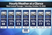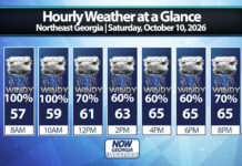

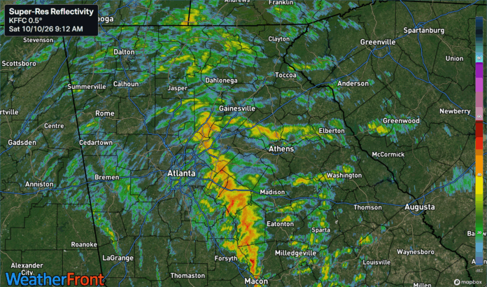
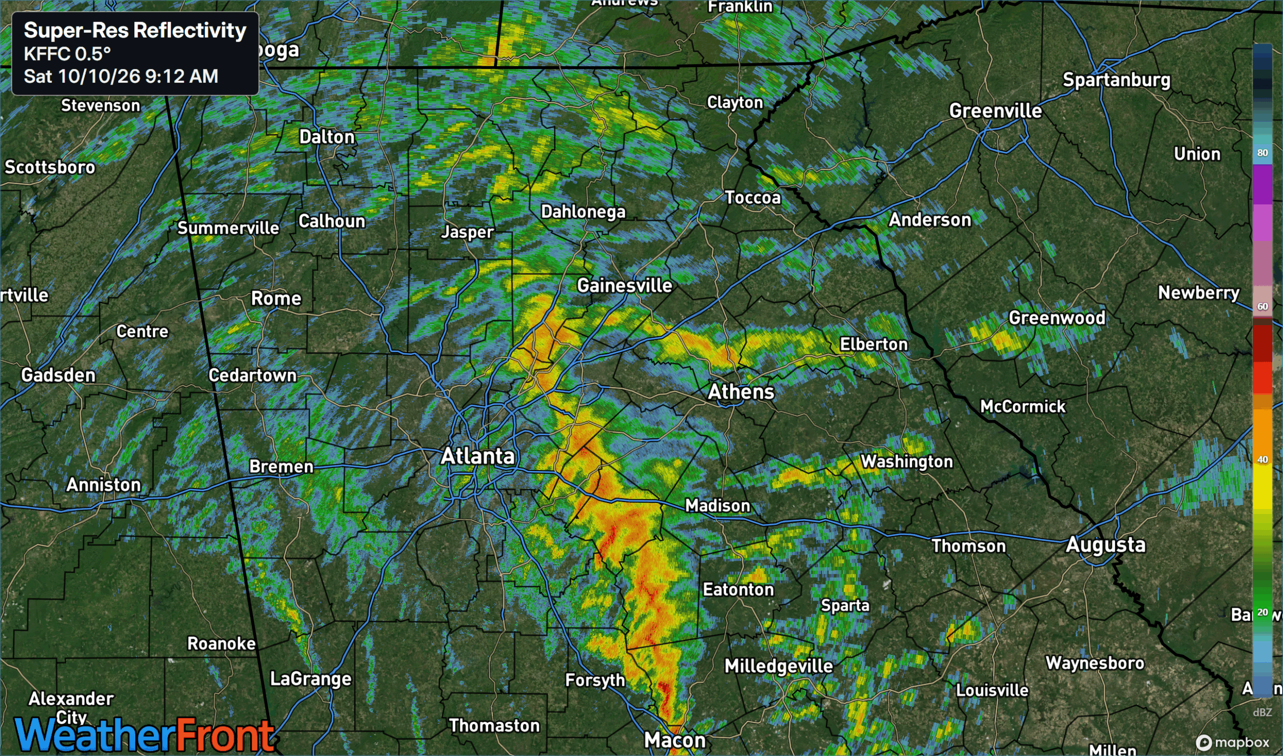
9:00 a.m.- The remnant center of Isaias is now located in central Alabama with widespread strong winds and heavy rain ongoing across North Georgia. Power outages have picked up over the past couple hours with widespread gusts of 30-40 m.p.h. reported. A band of extremely heavy rain has set up over eastern Atlanta and is rotating slowly east. Just north of this band wind gusts of 40-50 m.p.h. are occurring over the higher elevations around Jasper and Ellijay, with some damage to homes reported. Scattered power outages and downed trees are occurring, so today would be a good day to stay home.
Hurricane Isaias crashed into the U.S. Gulf Coast on Friday as a dangerous Category 2 hurricane, hammering communities in Alabama and the Florida Panhandle with damaging winds, heavy rain, flooding and life-threatening storm surges.
Isaias made landfall around 8:30 p.m. on Friday near Destin, Florida. At landfall, the National Hurricane Center had the storm rated a high-end Category 2 with winds of 110 m.p.h. Surface observations near the coast reported sustained winds of 90 m.p.h. with gusts to 116 m.p.h. The storm is moving north at 18 m.p.h. as it begins to be absorbed by an approaching front.
RELATED Gov. Kemp declares statewide emergency ahead of storm
Current Watches and Warnings
A Flood Watch and High Wind Warning have been issued for all of North and Central Georgia through this evening. All hurricane and tropical storm advisories have been cancelled.
High Wind Warning, Flood Watch in effect for most of North and Central Georgia
Flooding threat for Georgia
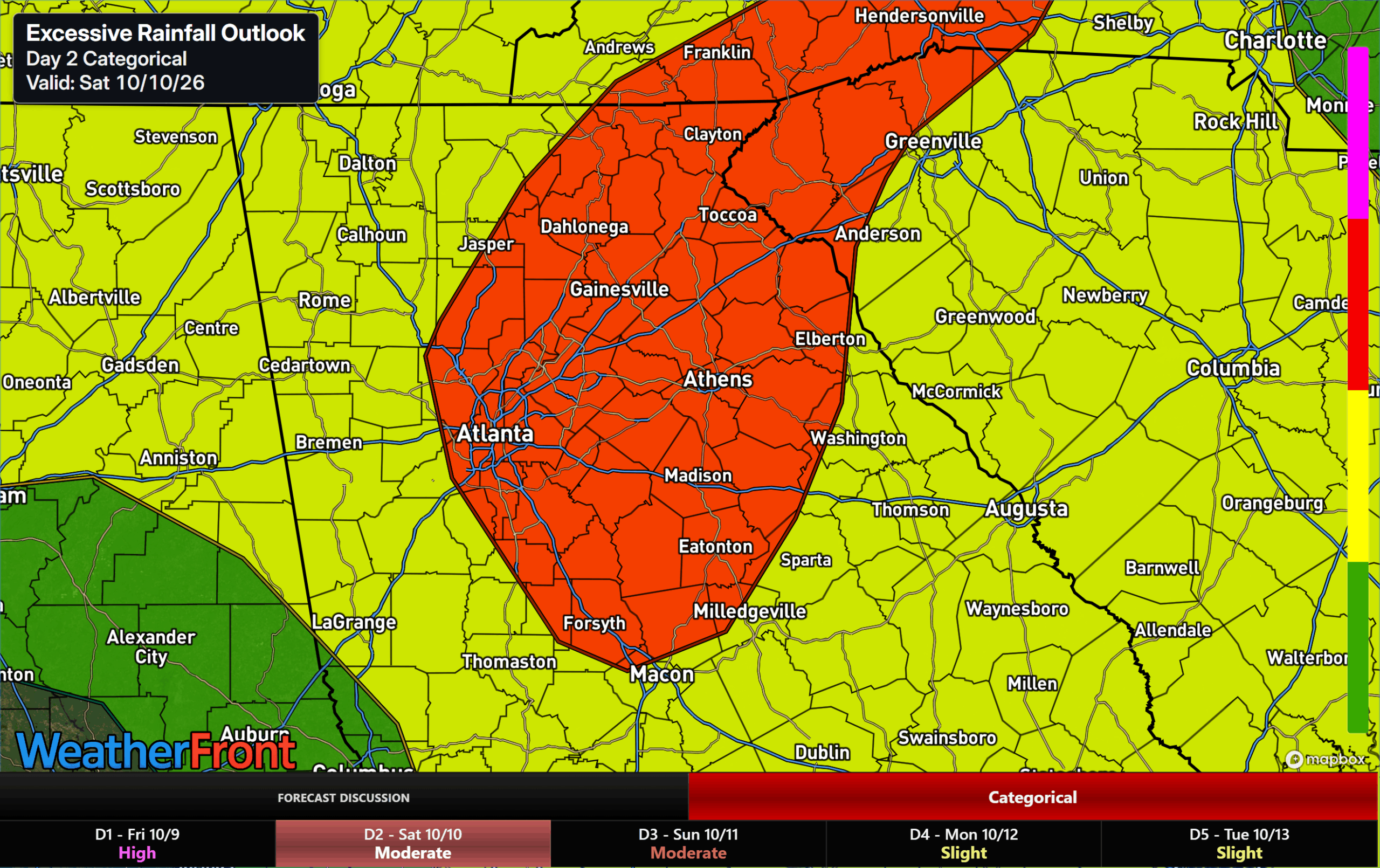
Flash flooding will be possible as the heavy rains on the eastern side of the remains of Isaias work through Georgia. The threat will start in southwest/west-central Georgia on Friday night where a slight (level 2/4) risk is in effect. Then, it will transition to the remainder of the state overnight and into Saturday/Saturday night. As the remnants are absorbed by the front they will slow down and turn northeast, keeping the northern part of the state at risk for heavy rains all day Saturday and into the night. Due to this, the Weather Prediction Center has placed all of Northeast Georgia under a moderate (level 3/4) risk for flooding.
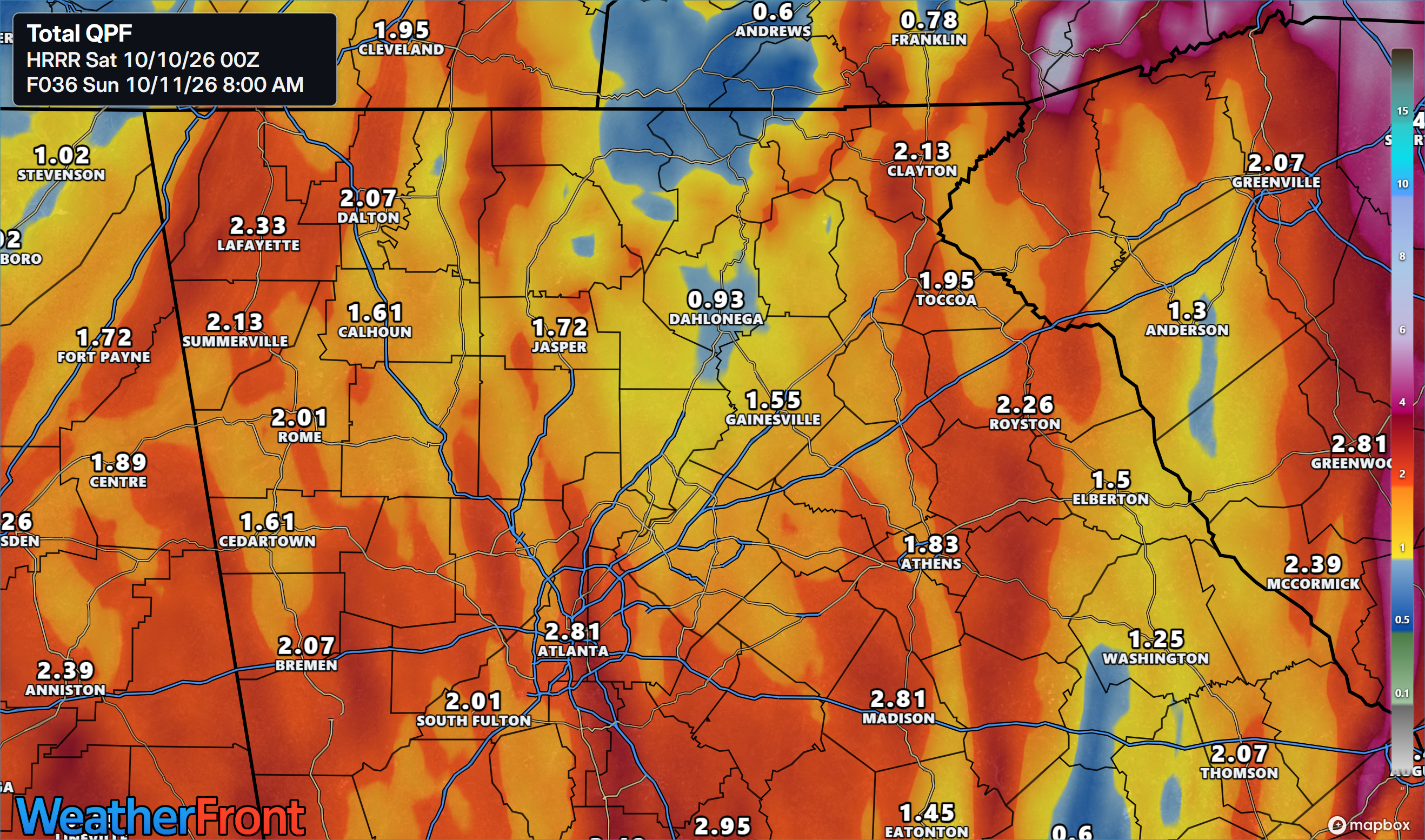
Total rainfall amounts are currently tracking in the 1.5-3″ range with isolated higher amounts possible- especially over the southeastern facing slopes of the mountains where the strong winds will provide the most lift. Heavy rain and flash flooding are possible all day Saturday and Saturday night as bands of rain move through on the eastern side of the circulation. Rainfall totals will be streaky, and the worst of it is looking increasingly likely to impact the WNC mountains to our north/east.
Strong winds Saturday
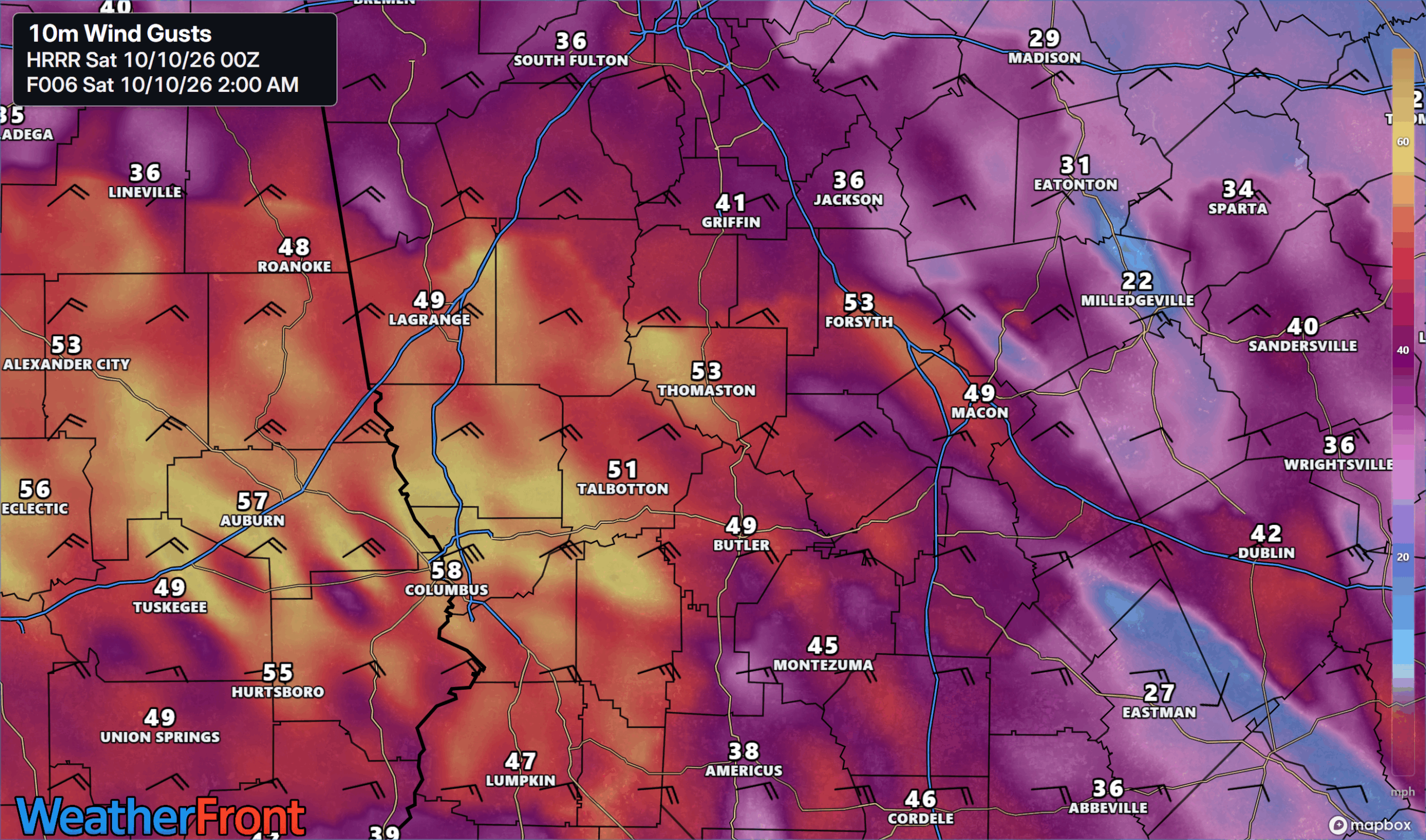
Strong, gusty winds are likely across the entire state from early Saturday morning through Saturday evening as well. The winds will pick up first across West-Central Georgia during the wee hours of Saturday morning. Here, gusts of 40-60 m.p.h. are possible as the core moves inland over Alabama. These winds will be from the east/southeast, which combined with wet soils will likely result in scattered to widespread power outages. The image below shows forecast gusts at 2 a.m.
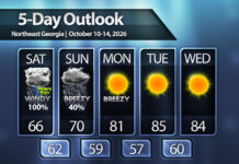
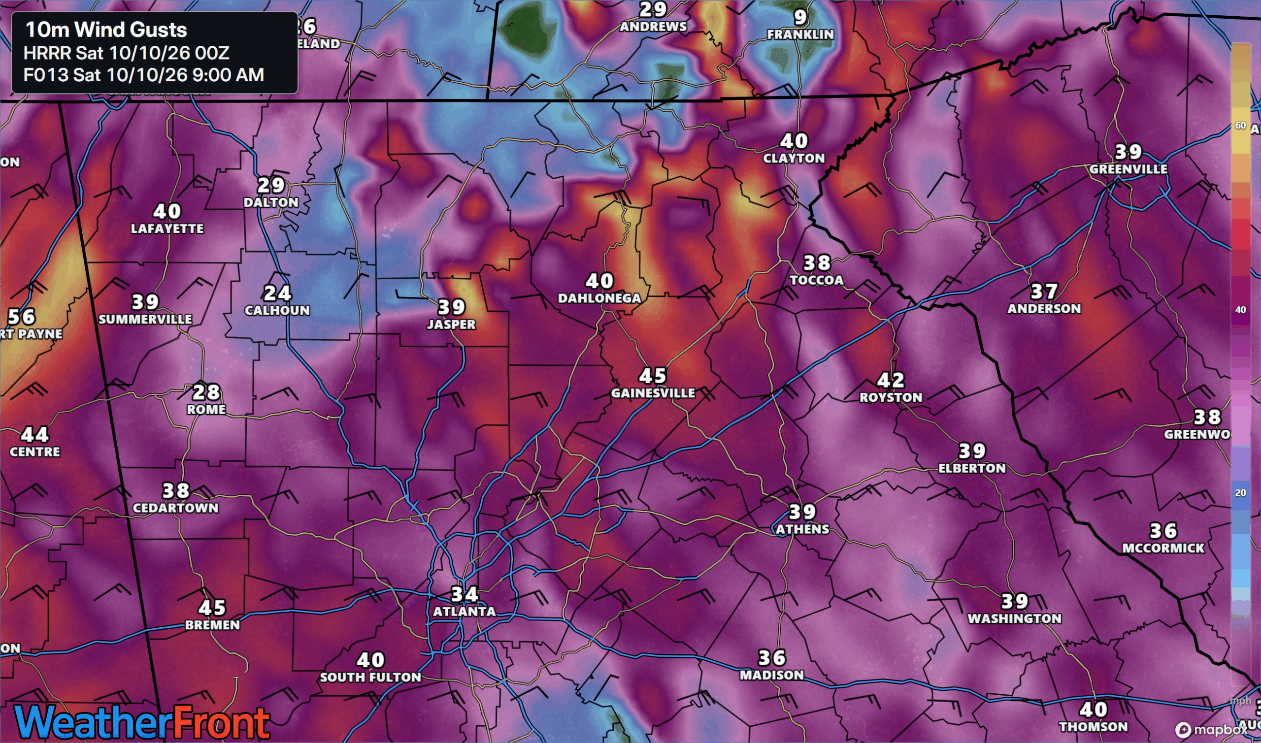
Across North Georgia winds will peak during the morning hours of Saturday as well. Current high resolution modeling shows the potential for wind gusts of 50-60 m.p.h. across the higher elevations, with 40-50 m.p.h. in the foothills. Those living on the north side of the higher elevations will likely be spared the worst due to wind direction, but scattered power outages are still likely across a chunk of the region. The worst winds are expected to arrive starting around 5 a.m. and lasting through mid-afternoon. They will remain gusty into Sunday as the remnant center slowly moves off to the northeast.
Threat of tornadoes in Georgia
A threat for tornadoes is also in place for a big chunk of the state on Saturday as well as the storm moves inland. The Storm Prediction Center has a large slight (level 2/5) risk for tornadic storms stretching inland from the coast towards Atlanta and up into South Carolina on Saturday, with a marginal risk (level 1/5) covering nearly the entire state.
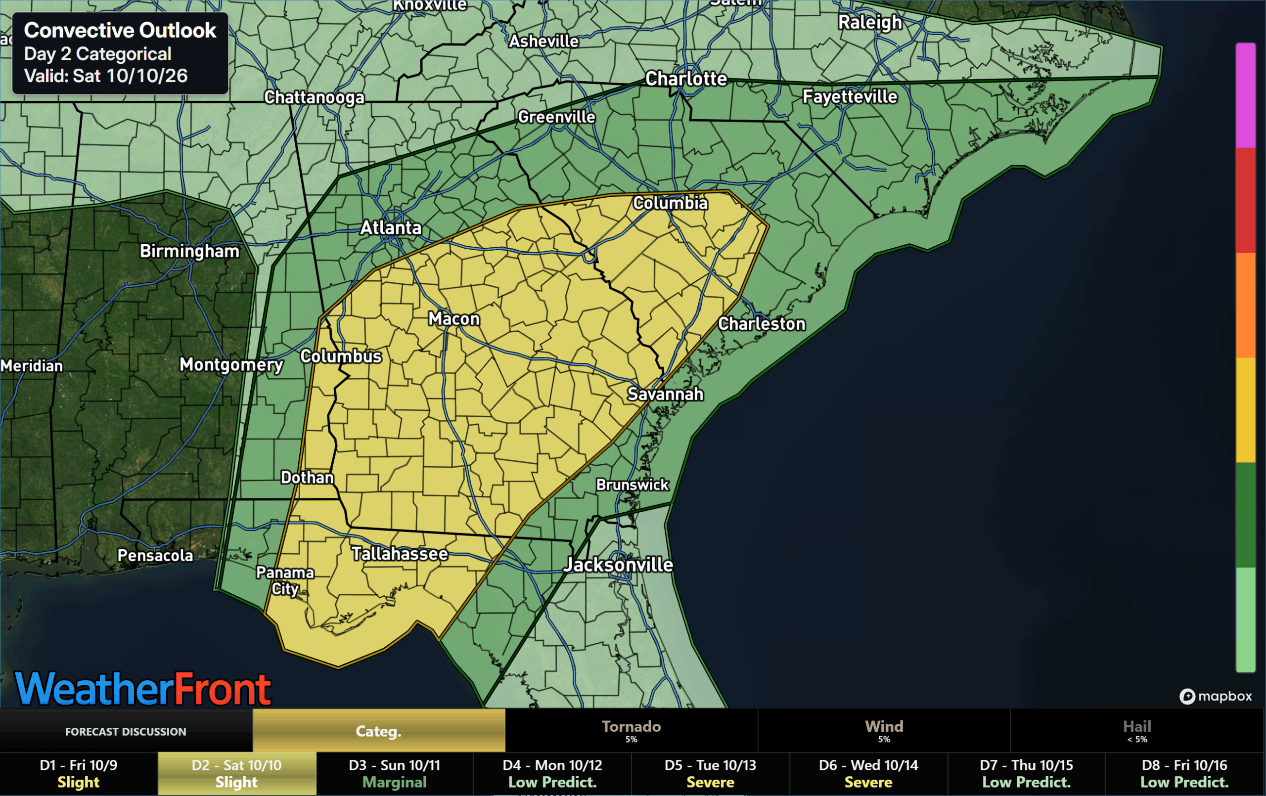
Tornadoes will be possible on the east side of the circulation at any time, and a few of these tornadoes could be strong.
Stay weather aware and stay safe!
Don’t miss what everyone in town is talking about.
Join 4,000+ locals and choose our free newsletter covering news, events and the stories shaping our region.