

MONDAY: Morning fog will burn off by lunch with sunshine through the afternoon. It will be another beautiful spring afternoon, but we’ll be watching an area of storms developing to the west. Current models keep it just south of our region, but we’ll be watching just in case.
TUESDAY: Skies will be partly to mostly cloudy with highs back into the mid/upper-70s once again. Isolated to scattered showers and storms are expected to develop once again during the afternoon with the warm/muggy airmass in place.
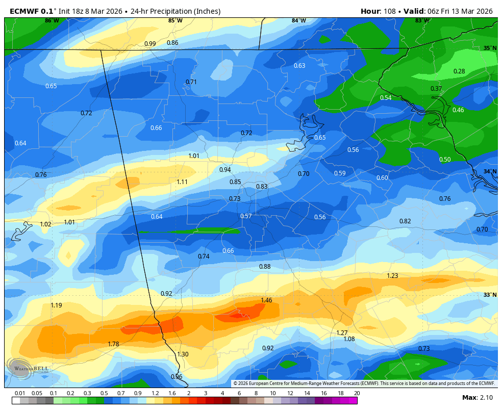
WEDNESDAY: A strong cold front will approach from the west. Current models show arrival overnight but timing on that could adjust as we get closer. Highs will reach to around 80º which will challenge record highs for the day. Otherwise, skies will be partly to mostly cloudy.
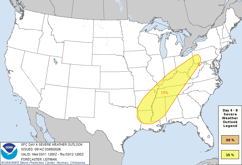
The Storm Prediction Center has outlined an area for severe storms to our west, and this threat could spread east overnight. Right now, with the overnight arrival overall severe threat appears low. We could see some decent rain totals around 1/2″ from the line of storms as well.
THURSDAY: A few storms will continue into the early part of the day. The front will clear by mid-morning, with likely some winds picking up in its wake. Sunshine will dominate in the afternoon. We’ll cool off significantly from where we are, but highs will remain in the mid-60s so right at average for this time of year. Overnight lows Thursday night will drop into the low-40s- our lowest in some time.
FRIDAY: Sunshine-y skies will dominate behind the front with highs returning to the low-70s.


