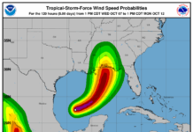

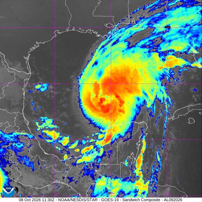
Isaias surged toward the U.S. Gulf Coast on Thursday as the first hurricane of the Atlantic season, prompting mandatory evacuations and school closures in parts of Florida.
Isaias was forecast to intensify rapidly and bring strong winds and a life-threatening storm surge to the Florida Panhandle, southern Alabama and southern Mississippi when it makes landfall on the northern Gulf Coast late Friday or early Saturday. Heavy rain with the risk of flooding was possible into the weekend as far inland as the Tennessee Valley.
Storm’s current track
As of 5 a.m. Isaias had maximum sustained winds around 80 mph and was moving east-northeast at 9 mph early Thursday morning. It was centered about 420 miles south-southwest of the mouth of the Mississippi River. A turn to the north will occur today as well as an increase in forward speed. Timing of the landfall has sped up from earlier modeling, with a landfall now likely late Friday or in the wee hours of Saturday morning. The storm will then move inland quickly bringing impacts to the entire southeast.
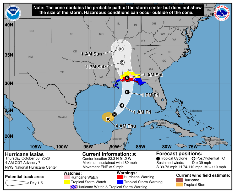
A Hurricane Warning is in effect for the Alabama Gulf Coast and extreme western Florida Panhandle, including Mobile and Pensacola. A Tropical Storm Warning is in effect for the entire southeastern Louisiana coastline as well as the central Florida Panhandle including Panama City and Apalachicola.
The storm is already interacting with an approaching upper level trough, and it will continue to do so as it makes its run towards the coast.
Gulf Coast braces for impact
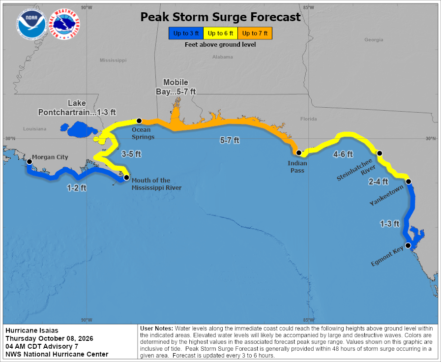
Despite the weakening trend expected to be ongoing as the storm makes landfall, significant storm surge is still expected along the Gulf Coast. 5-7ft of surge is likely from Ocean Springs, MS to Indian Pass, FL. This includes Mobile Bay, Pensacola, Panama City and Apalachicola.
Coastal communities moved quickly to prepare. Some Gulf oil wells paused production, and at least four Florida school districts canceled classes for later in the week while Okaloosa County announced mandatory evacuations for some coastal areas. Governors in Florida and Alabama declared a state of emergency for dozens of counties.
Flooding threat for Georgia
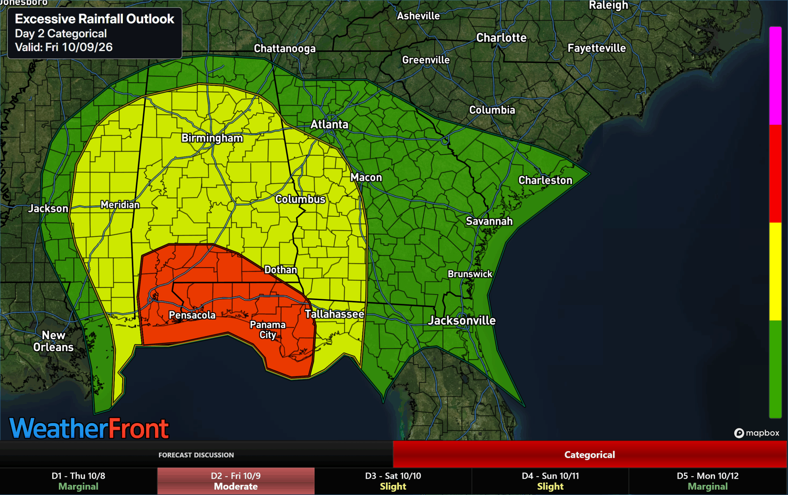
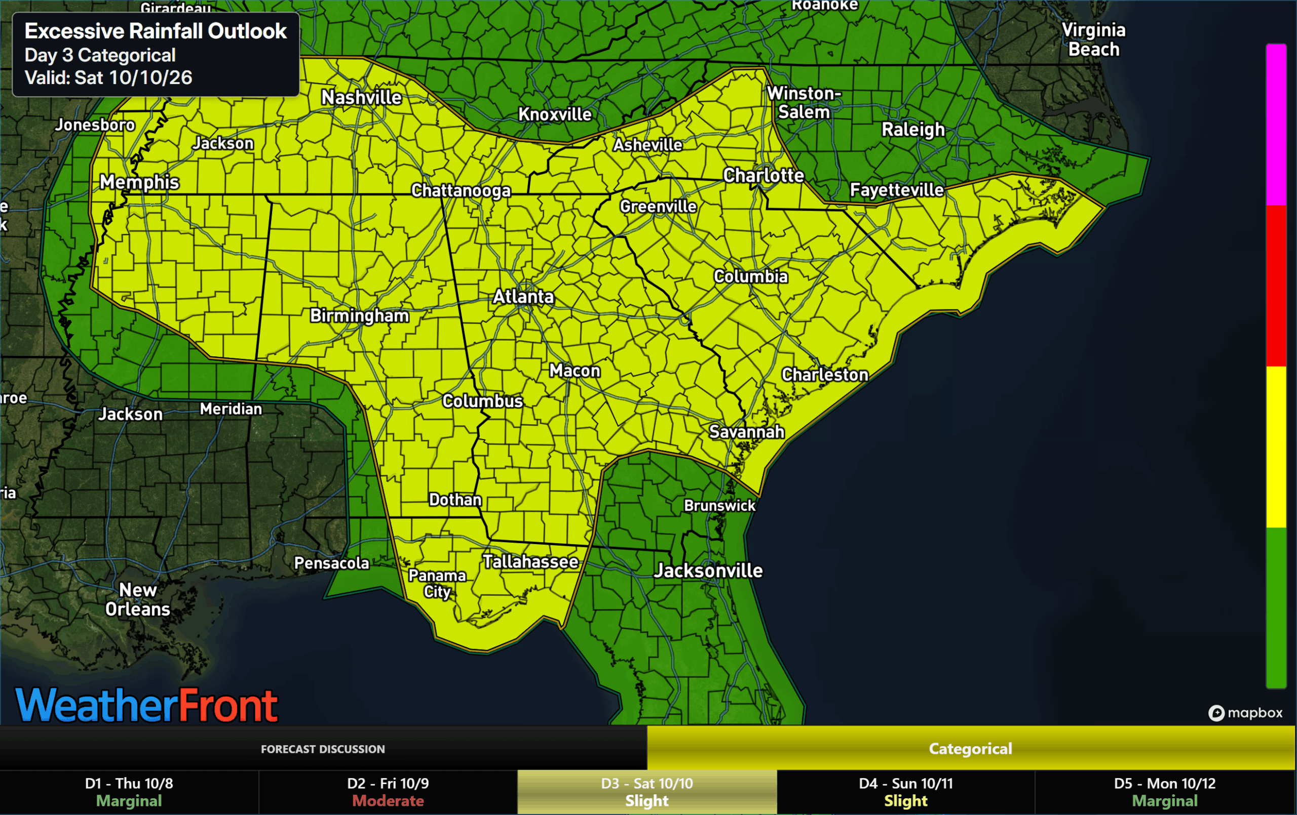
Flash flooding will be possible as the heavy rains on the eastern side of the remains of Isaias work through Georgia. The threat will start in southwest/west-central Georgia on Friday where a slight (level 2/4) risk is in effect. Then, it will transition to the remainder of the state overnight with a slight (level 2/4) risk in effect for nearly the whole state on Saturday.
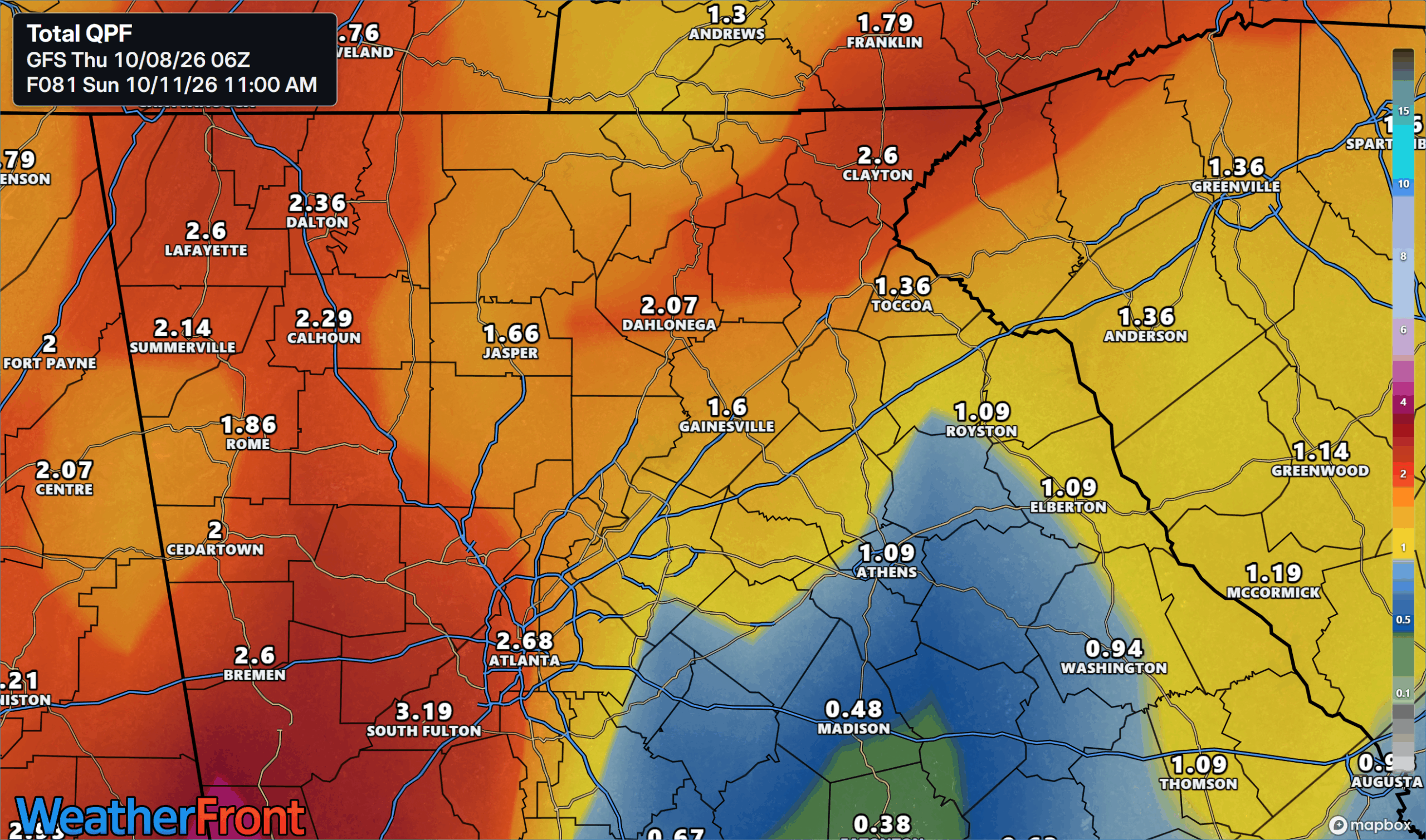
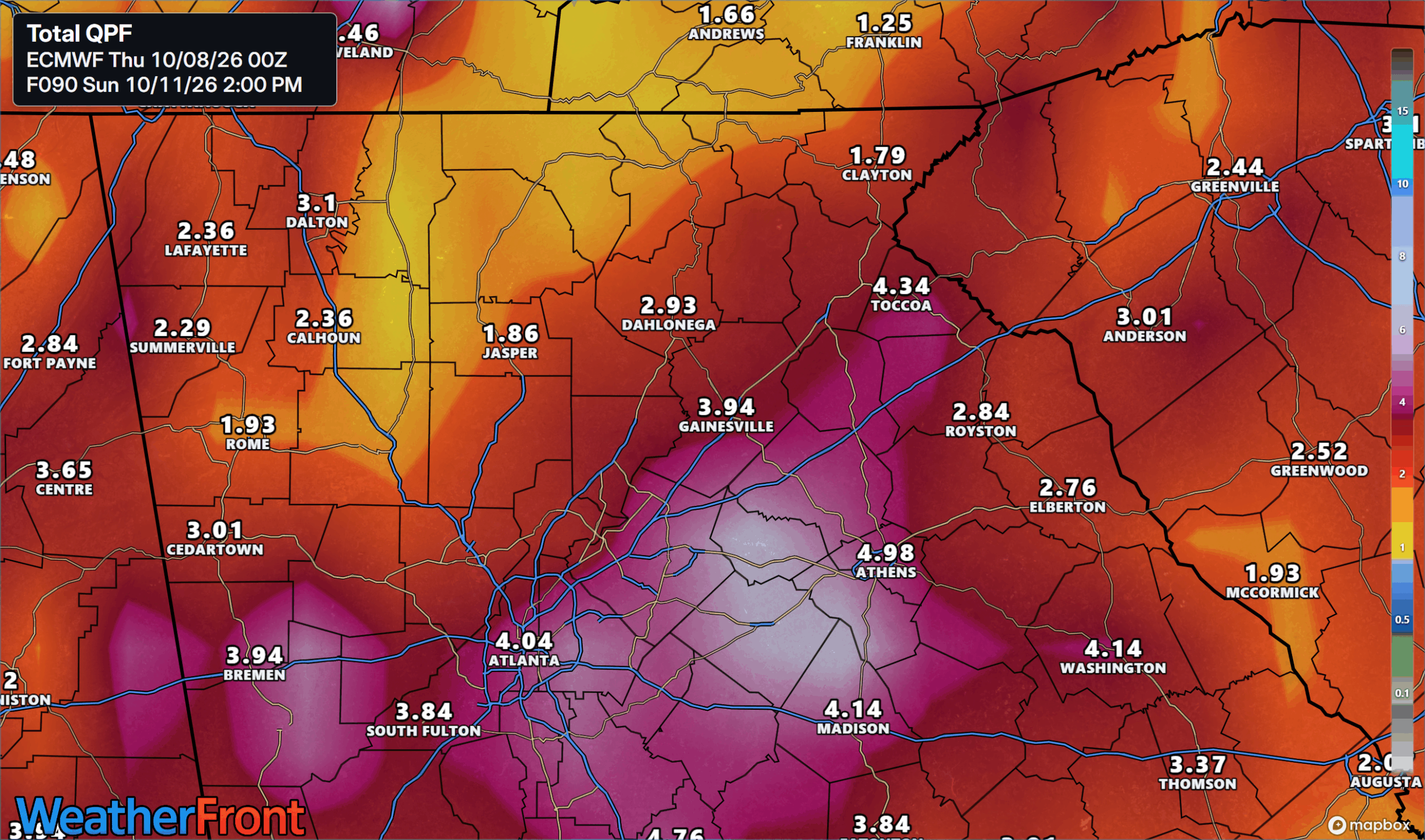
Total rainfall amounts are currently tracking in the 1.5-3″ range with isolated higher amounts possible- especially over the southeastern facing slopes of the mountains where the strong winds will provide the most lift. This rain will mostly fall in very quick order from early Saturday morning through Saturday evening.
Strong winds Saturday
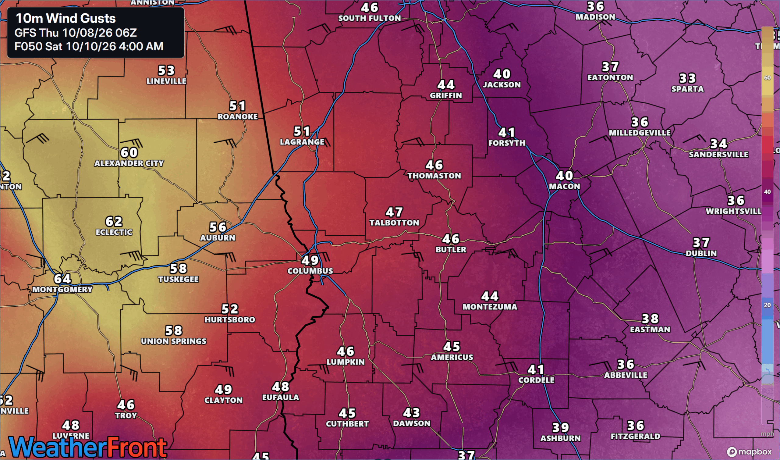
Strong, gusty winds are likely across the entire state from early Saturday morning through Saturday evening as well. The winds will pick up first across West-Central Georgia during the wee hours of Saturday morning. Here, gusts of 40-50 m.p.h. are possible as the core moves inland over Alabama. These winds will be from the east/southeast, which combined with wet soils will likely result in scattered power outages. Any eastward shifts of the “center”, or what is left by then, could increase these numbers.
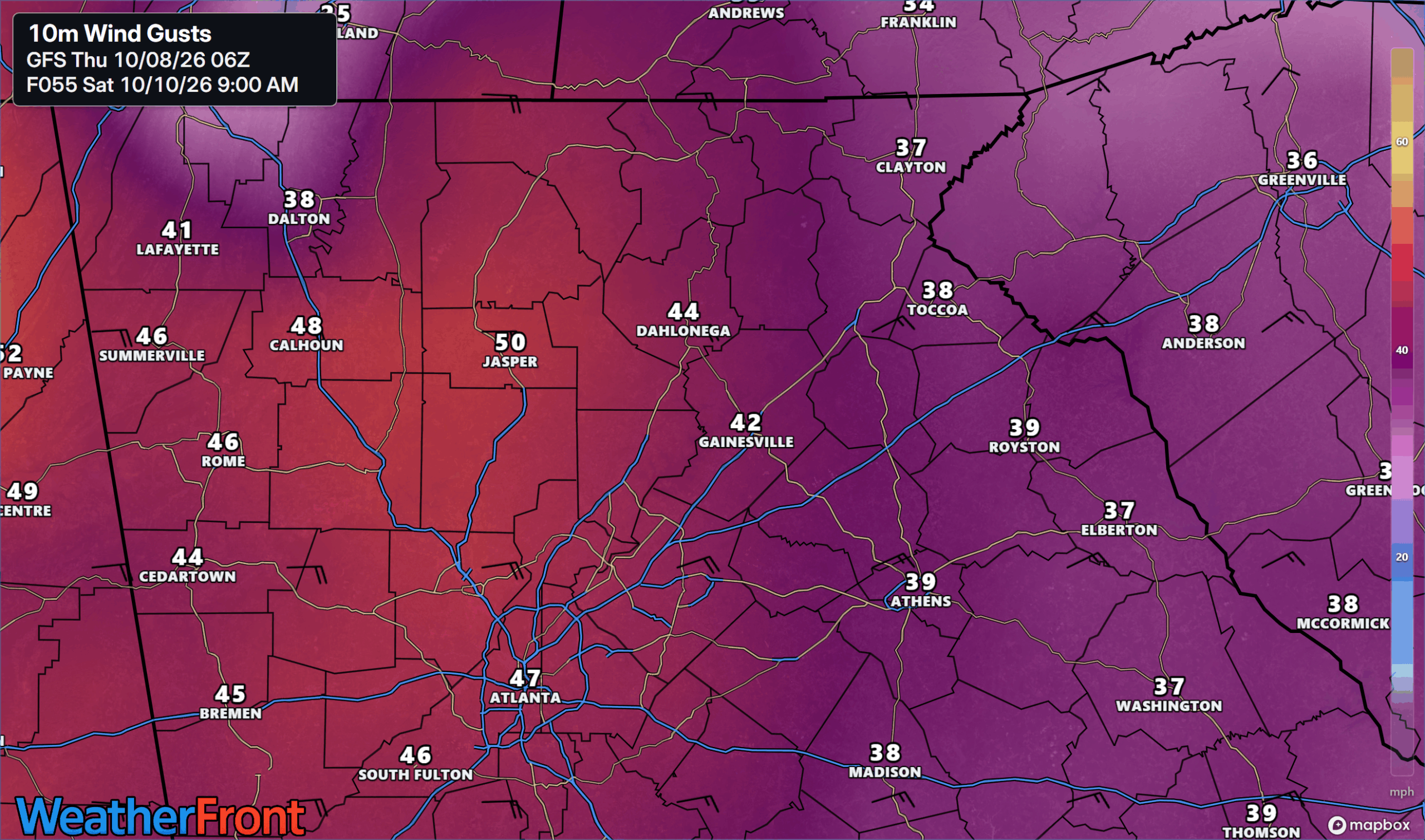
Across North Georgia winds will peak during the morning hours of Saturday as well. Gusts will be strongest across Northwest Georgia where 40-50 m.p.h gusts are also possible, and highest over the higher elevations. For eastern Georgia the tight pressure gradient will still result in strong wind gusts of 30-40 m.p.h. Again, east winds this strong are not something our trees are used to, so combine that with wet ground and there’s a recipe for scattered power outages.
Threat of tornadoes in Georgia
A significant tornado threat may evolve across part, if not most, of the state on Saturday as well as the storm moves inland. Isaias will have a ton of energy needing to be dispelled as it gets absorbed by the incoming trough/cold front. Feeder bands on the east side of the storm will contain rotating storms, and tornadoes are possible. The Storm Prediction Center has a large slight (level 2/5) risk for tornadic storms stretching inland from the coast towards Atlanta on Saturday, with a marginal risk (level 1/5) covering the entire state.
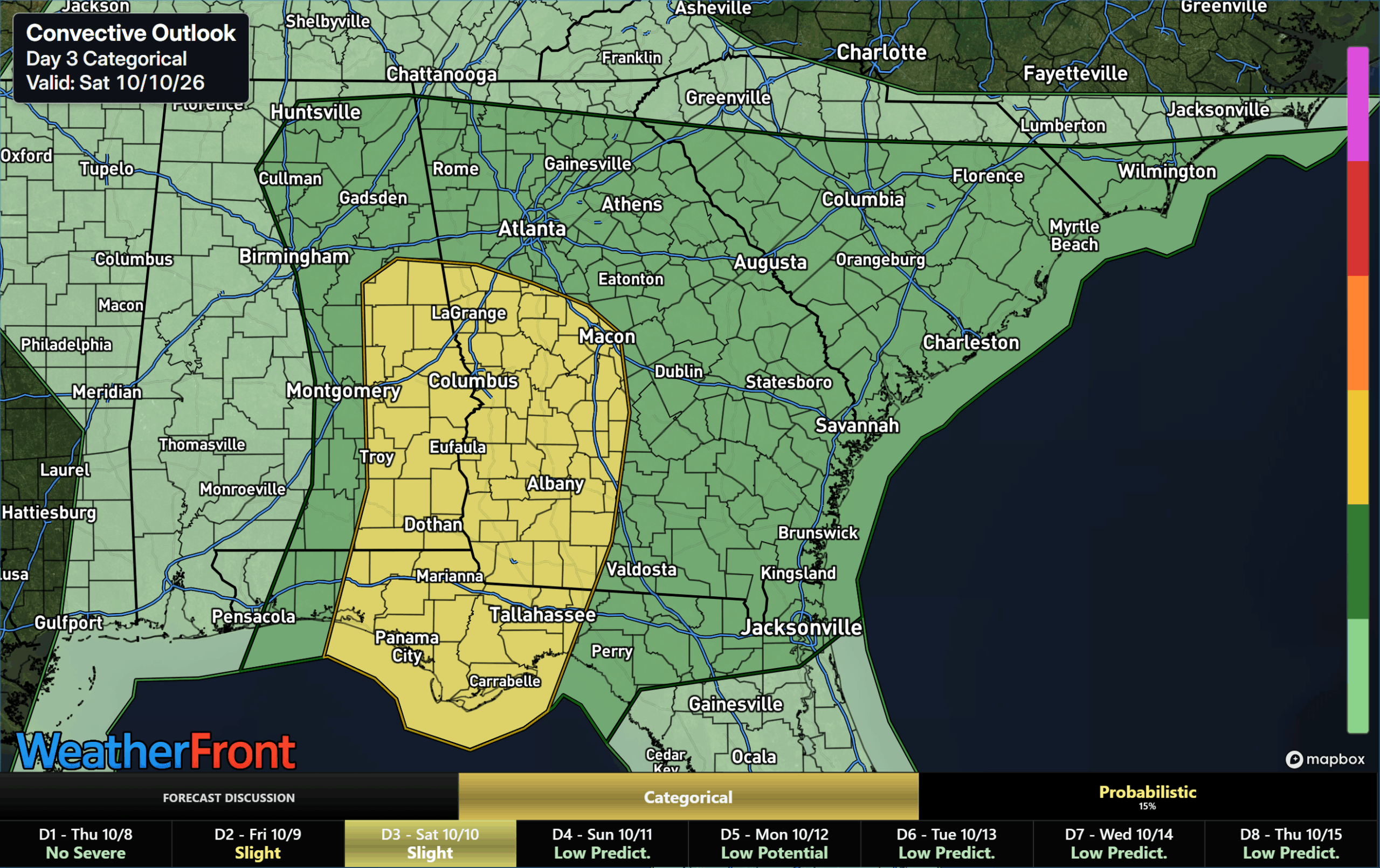
Timing of the tornado threat is still being nailed down, and additional adjustments to the highest threat area are likely as models hone in on the exact path the core takes after landfall. For West-Central Georgia some strong tornadoes are possible with strong winds just above the surface. For Northeast Georgia the threat will be lower, but a few short-lived tornadoes are still possible.
We’ll have continued updates as Isaias continues to march through the Gulf and towards the southeast.
Don’t miss what everyone in town is talking about.
Join 4,000+ locals and choose our free newsletter covering news, events and the stories shaping our region.