
AREA Weather
Here comes the wedge
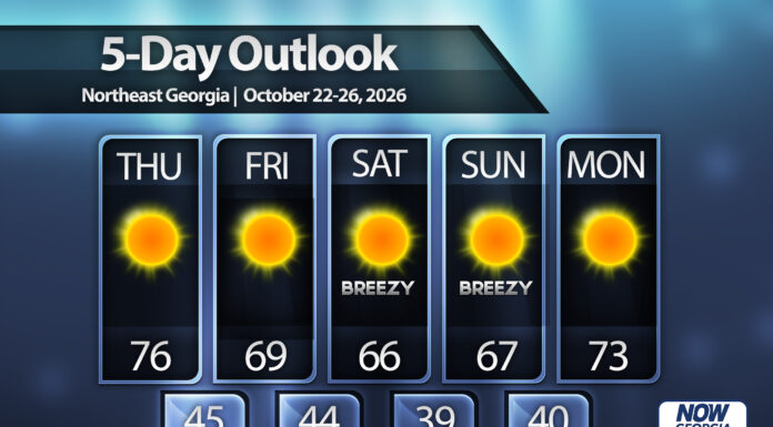
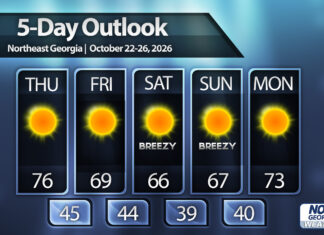
Sunshine will continue to dominate for the foreseeable future as we move into a stagnant, dry, but nice weather pattern. Fire danger will be very high on Thursday afternoon with humidity levels expected to fall into the 20% range.
High pressure will build in from the northeast from Friday into Saturday, sending a dry wedge into the region which will drop highs back into the 60s over the weekend. Winds will also be breezy on Saturday and Sunday with gusts of 15-20 m.p.h. expected.
When is the next rain chance? Who knows - models are keeping any rain chances in the 7-10 day range.
SEE ALSO
https://nowgeorgia.com/wheres-the-rain/