

Isolated severe storms are possible across all of North Georgia on Sunday afternoon as a cold front sweeps through the region.
The Storm Prediction Center has placed most of North Georgia under a Slight (level 2/5) risk for severe storms with a Marginal (level 1/5) extending into parts of Central Georgia.
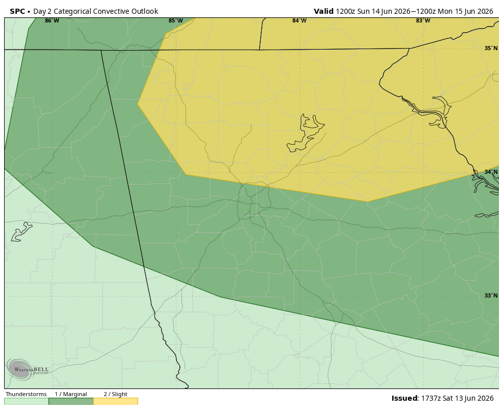
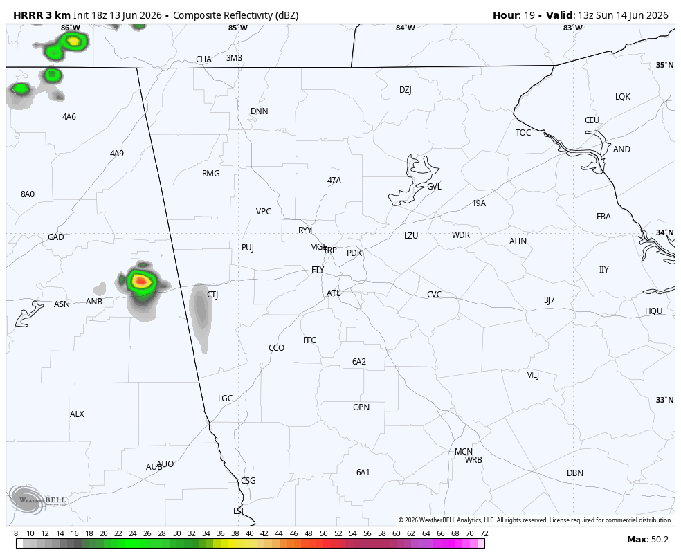
Afternoon storms are expected to develop ahead of an approaching front from the west and push west to east through the afternoon and evening. Afternoon highs well into the 80s will provide plenty of fuel for these storms. The primary threat will be damaging winds, though some small hail is also likely with the stronger storms. The risk will occur mainly from 12 p.m. through 9 p.m. Simulated radar below from Sunday morning into Sunday evening shows the bulk of the activity between 1-5 p.m. A few storms may persist past sunset but will be generally weakening as daytime heating subsides.
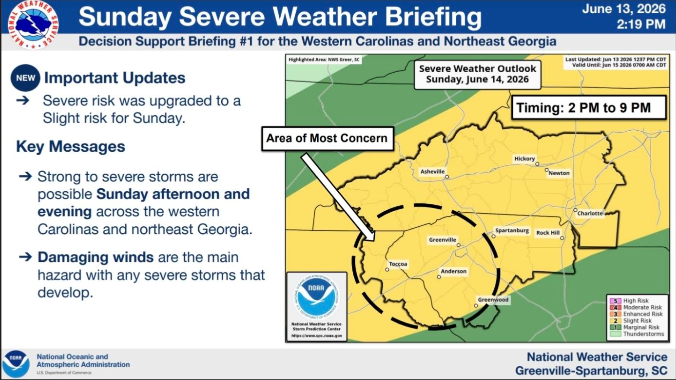
The latest update from the NWS in Greenville can be seen below. Stay with Now Georgia for any updates on the severe potential.
Don’t miss what everyone in town is talking about.
Join 4,000+ locals and choose our free newsletter covering news, events and the stories shaping our region.


