
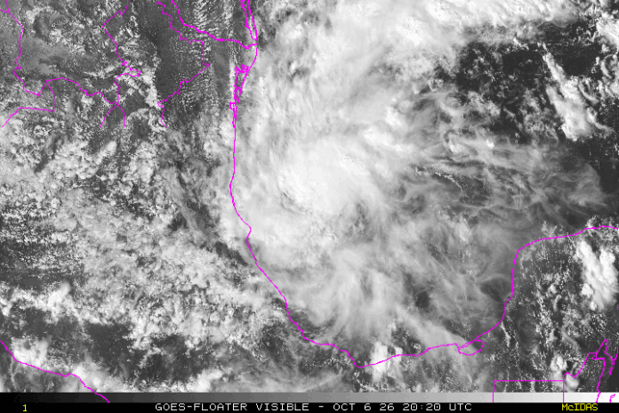
As of 5 p.m. eastern the National Hurricane Center has begun advisories on Tropical Depression 9 in the Bay of Campeche. Over the next few days, TD9 will strengthen into Tropical Storm Isaias and potentially reach hurricane strength before bringing impacts inland along the Gulf Coast and Southeastern US.
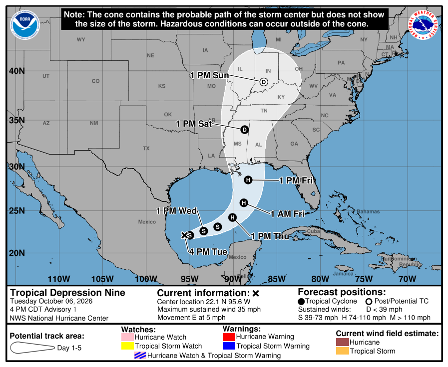
This is a fairly complicated set-up, as eventual Isaias will be interacting with a front as it moves north. This could result in a tropical storm or weak hurricane in the southern/central Gulf that loses its tropical characteristics but remains strong while moving into the coast this weekend. However, weather models today have been much more bullish on keeping the storm fairly, or completely, organized all the way to landfall somewhere between Southern Louisiana and the Florida Panhandle.
This complicated set-up is extremely common for October, especially during strong El Niño years. Upper level wind shear could make it difficult for the storm to maintain, or it could enhance it (as seen with Zeta 2020). While weakening at landfall is more likely, the possibility of a stronger storm making landfall and spreading impacts well inland is possible. The latest run of the Euro model is below. With this solution landfall would occur Saturday morning (this seems likely regardless) with the storm moving very quickly into the northeast by Sunday night.
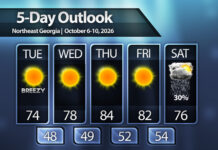
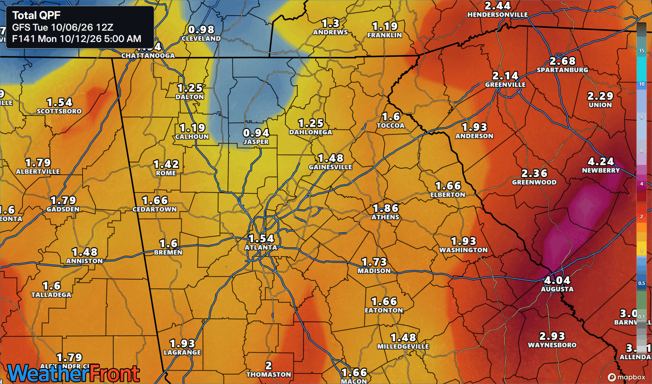
The main risks across Georgia will be flooding rains and severe storms. Different models output different amounts of rain, and the track of the center will be key. A track near or to our west will result in a higher rain/tornado threat with a track east of us will limit impacts much more. With that said current models are fairly consistent with 1-2″ and isolated higher amounts across most of Central and North Georgia on Saturday and Sunday. The quick speed of the storm should help keep totals from being too extreme, but it bears watching.
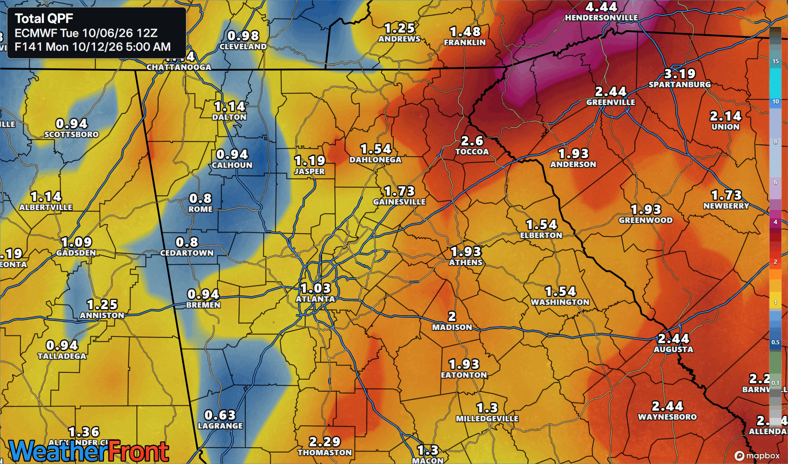
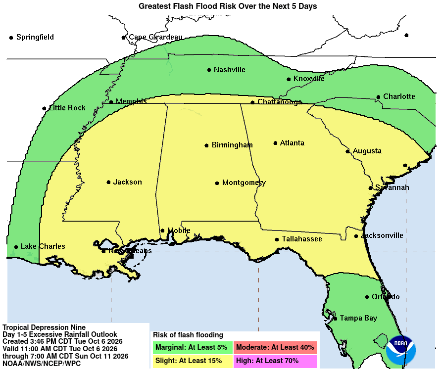
The Weather Prediction Center has placed the entire state under a slight (level 2/4) risk for flash flooding over the next 5 days, a forecast that will be more refined over the coming few days.
Ultimately there is still a lot to be determined with future Isaias, but we’ll be keeping a close eye on it through the next few days and keep you up to date on the latest.
Don’t miss what everyone in town is talking about.
Join 4,000+ locals and choose our free newsletter covering news, events and the stories shaping our region.