

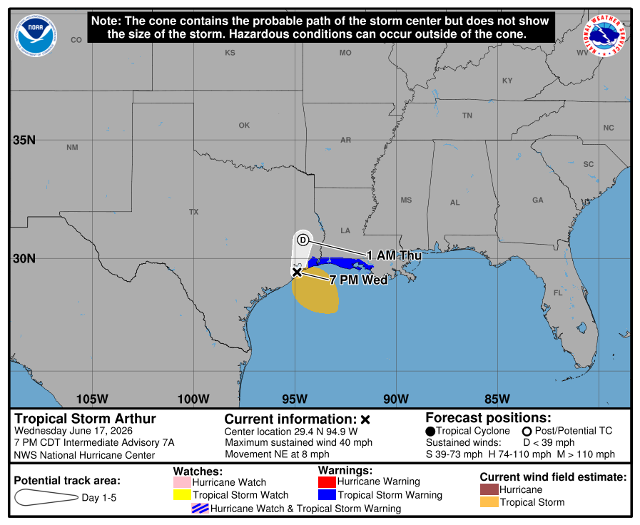
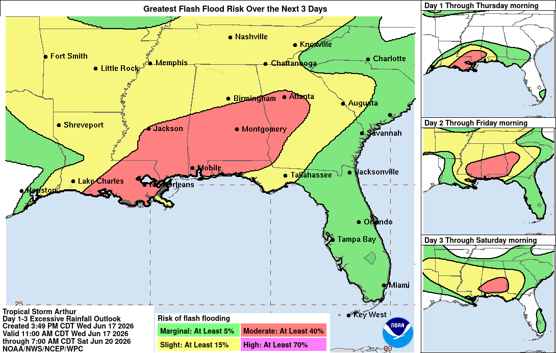
Tropical Storm Arthur is proving to be very short-lived just as anticipated. The storm never got fully over water and will move back inland overnight Wednesday dissipating in Louisiana by sunrise. The remnant low and associated tropical moisture will bring a risk of flooding and strong storms to Georgia late Thursday through Friday.
A Flood Watch is in effect for Baldwin, Barrow, Bartow, Bibb, Bleckley, Butts, Carroll, Chattahoochee, Cherokee, Clayton, Cobb, Coweta, Crawford, Crisp, DeKalb, Dooly, Douglas, Fayette, Forsyth, Greene, Gwinnett, Hancock, Haralson, Harris, Heard, Henry, Houston, Jasper, Jones, Lamar, Macon, Marion, Meriwether, Monroe, Morgan, Muscogee, Newton, North Fulton, Oconee, Paulding, Peach, Pike, Polk, Pulaski, Putnam, Rockdale, Schley, South Fulton, Spalding, Stewart, Sumter, Talbot, Taylor, Troup, Twiggs, Upson, Walton, Washington, Webster, and Wilkinson which includes all of West Central Georgia and the Chattahoochee Valley from Thursday morning through Friday night.
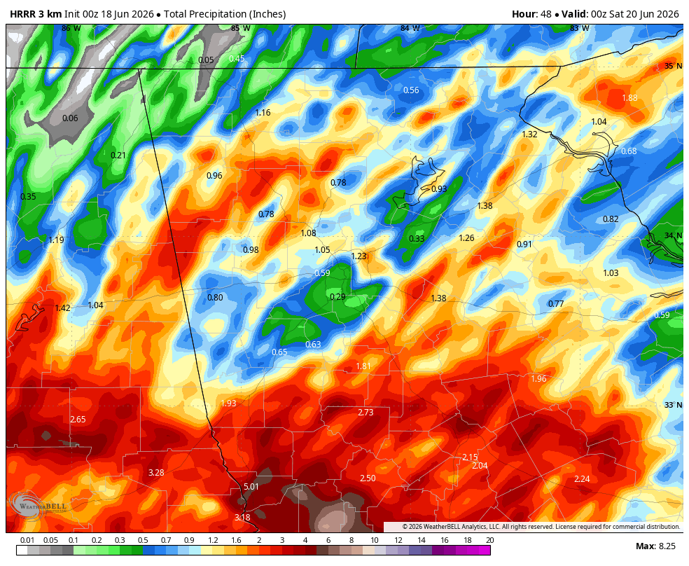
An incoming front will act as a focus for heavy rain to fall across all of Georgia from Thursday evening into the overnight and much of Friday. The latest modeling continues to keep the highest rainfall totals along and south of the I-20 corridor with more scattered higher totals north. The high resolution models are now getting within good range of the system, and generally tend to handle the tropical moisture pretty well. The image below shows the latest from the HRRR. Don’t take the swaths of heavy rain verbatim, but it shows the general likely streaky nature of the 1-3″ totals across the northern parts of the state with a more widespread 2-4+” further south. These totals could still bump north, in fact some models do show higher totals further north than this, so stay aware in case of any changes.
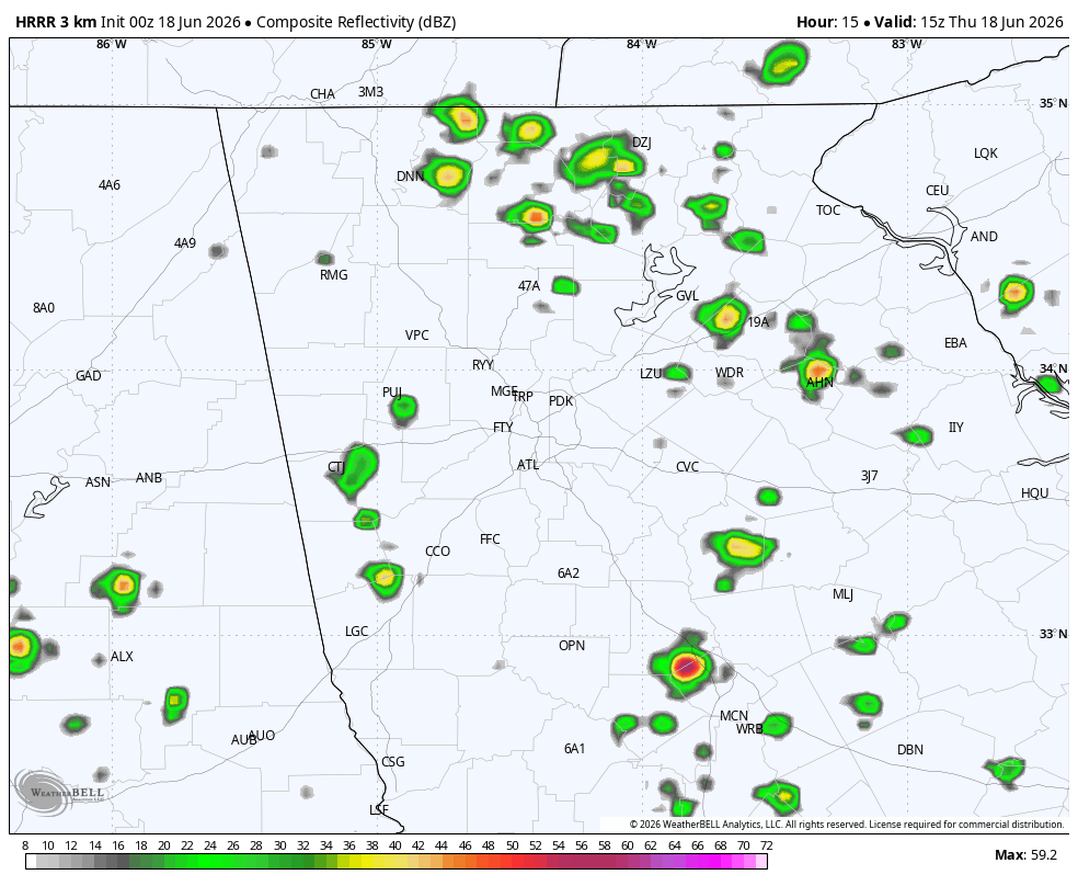
Rain is expected to be scattered to start the day Thursday but become widespread and at times heavy overnight and through the first part of Thursday. The animation below runs from 11AM Thursday through 11AM Friday.
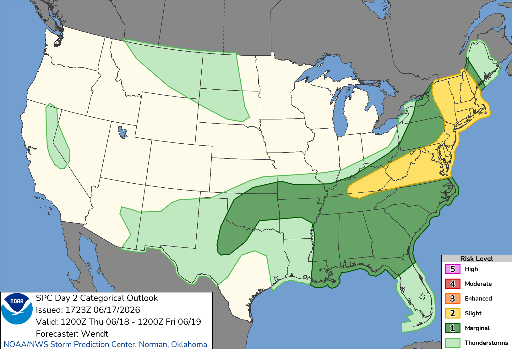
Winds will be breezy at 20-25 m.p.h. across the entire state on Thursday, with occasionally gusty winds continuing overnight and into Friday. With the storms nearby and stronger winds above the surface, an isolated severe storm is possible that could produce wind gusts of 50-60 m.p.h. The initial line of storms that moves from south to north during the afternoon on Thursday will bring the biggest risk, but another is likely with the remnant low on Thursday night. The Storm Prediction Center has the entire state under a marginal (level 1/5) risk for severe storms on Thursday.
West-Central Georgia will likely be hardest hit by the rainfall and flooding risk, and that area remains under a moderate (level 3/4) risk for flash flooding.
Stay weather aware over the next 48 hours!
Don’t miss what everyone in town is talking about.
Join 4,000+ locals and choose our free newsletter covering news, events and the stories shaping our region.


