

A widespread, long running drought has continued to worsen across Georgia as rain chances remain limited.
Current Drought Information
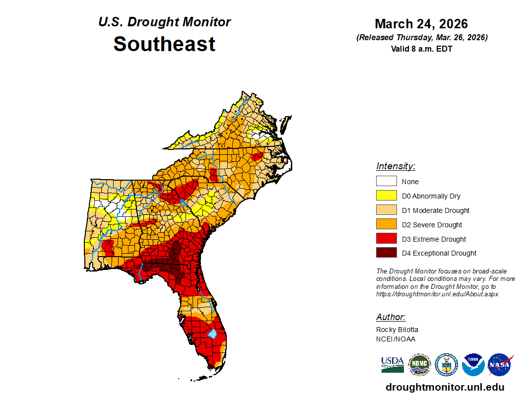
The latest from the US Drought Monitor shows continued small expansions of the drought areas across the state. The entire state remains under at least abnormally dry conditions, with 92% in at least a moderate drought and 80% in at least a severe drought. The D3, or extreme drought, category has expanded to cover 42% of the state and the D4, exceptional drought, has been reintroduced and is rapidly growing to 7% over South Georgia.
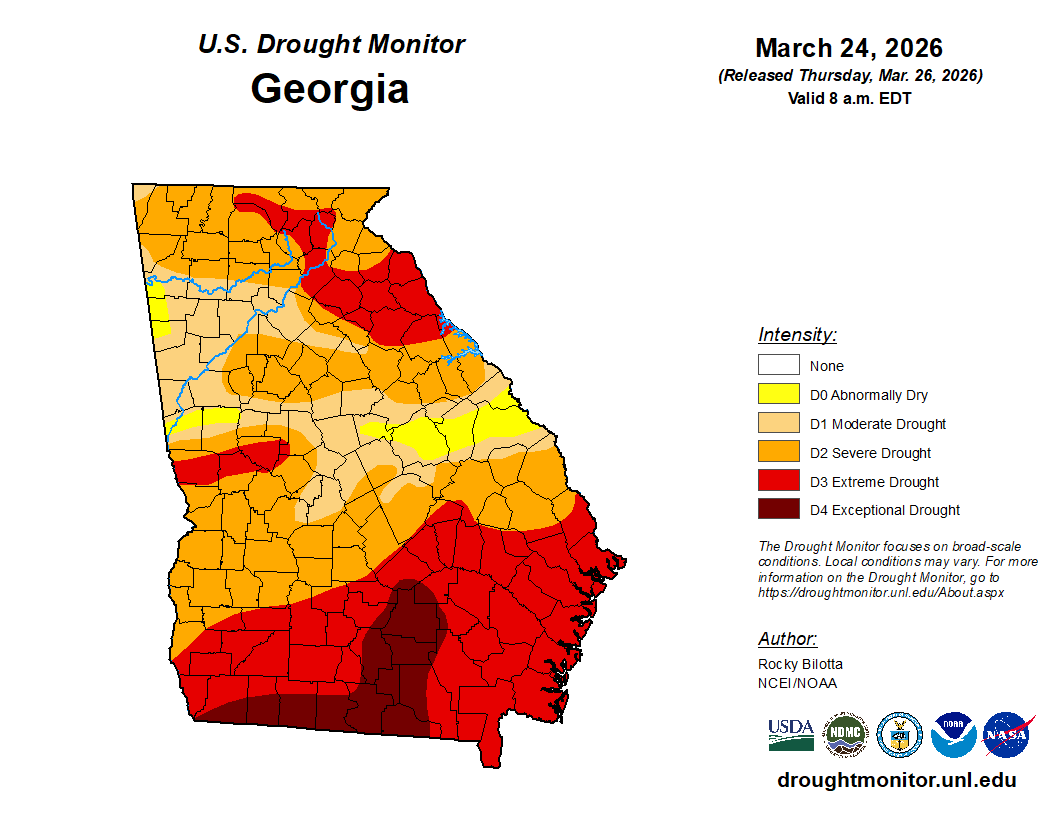
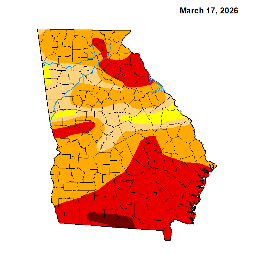
Compared to just last week, this is a noticeable expansion of the extreme drought over Northeast Georgia and a considerable increase in the exceptional drought category over far South Georgia.
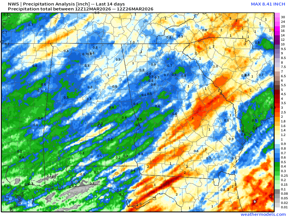
This really isn’t much of a surprise. Little to no rain has fallen across the majority of the state in the past 7 days. In fact, you have to go back a full 2 weeks to have seen generally 1″ or less in the northern half of the state with up to 2″ further south/east.
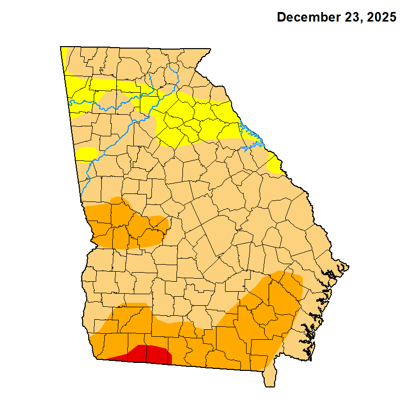
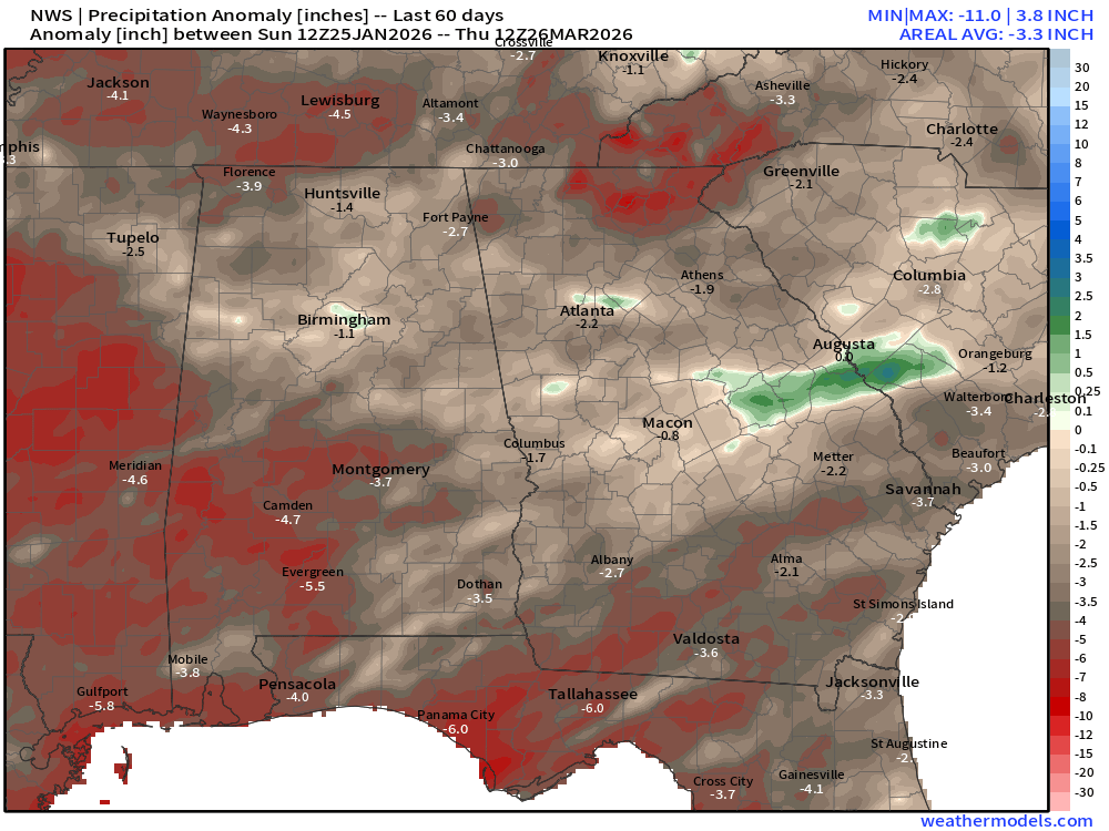
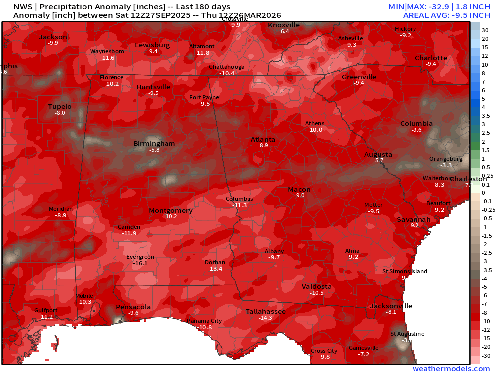
This has been a long standing drought across the region stretching back well into 2025. Below you can see the rainfall deficits for both the last 60 and 180 days. For a lot of the state, we have seen some relative improvement in the deficits in the past 2 months, but if you look back at the past 6 only a very small area south of I-20 running from west to east is even within 4″ of normal. The majority of the state is between 8-12″ below normal since September.
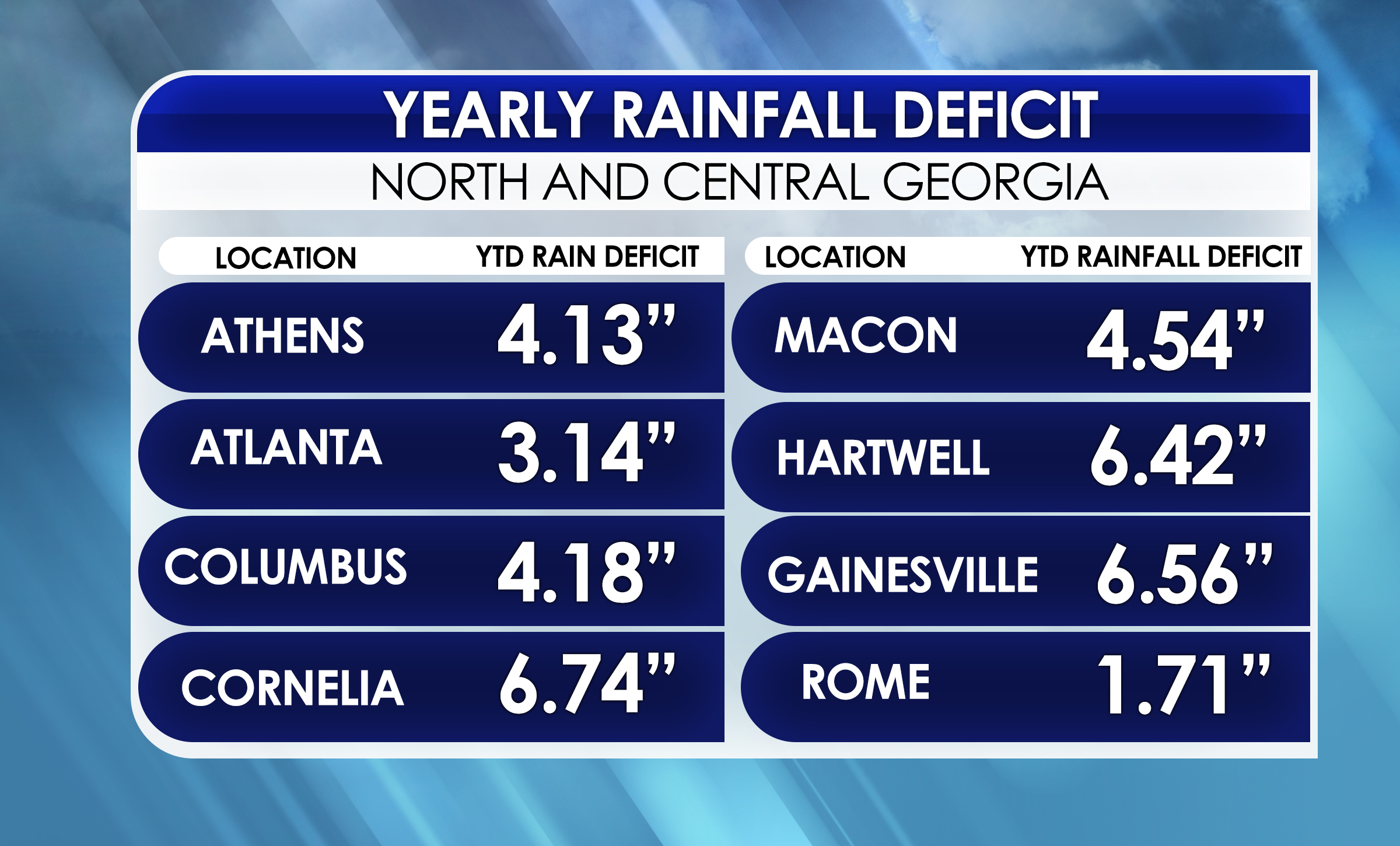
Year to date deficits can be seen below for some select cities. Northwest Georgia has fared by far the best thanks to thunderstorms from our past couple severe weather threats, but everyone else is between 3-7″ below normal since the beginning of the year.
The drought is widespread not only across Georgia, but all of the southeast. Florida is also being hit particularly hard, with South and North Carolina also experiencing widespread severe drought or higher conditions.
Upcoming rain?
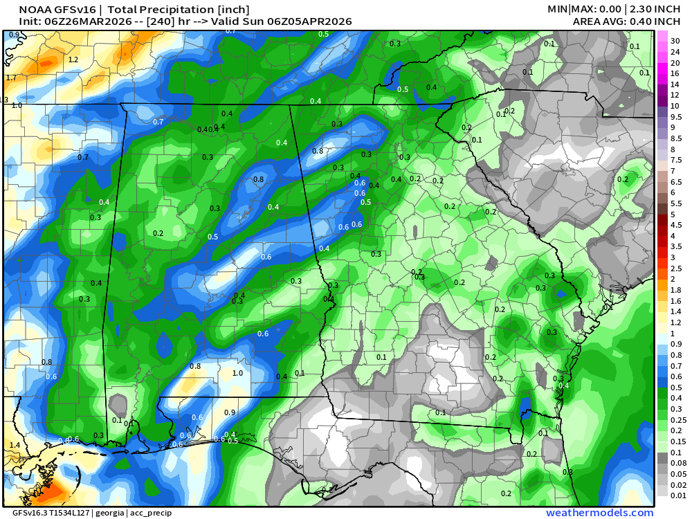
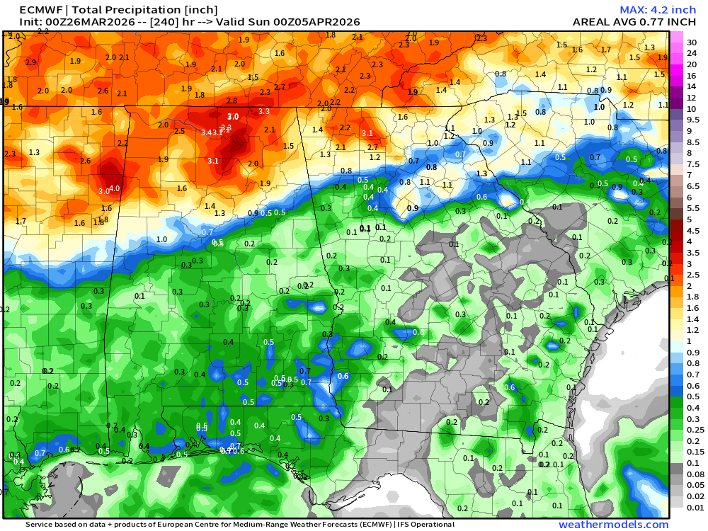
Unfortunately, the upcoming weather pattern continues to look very dry. While both the Euro and GFS models do show some potential for rainfall in the next 10 days, they are very far apart on where and how much the best totals might be. Currently our next best rain chance is expected as we head into Easter weekend.
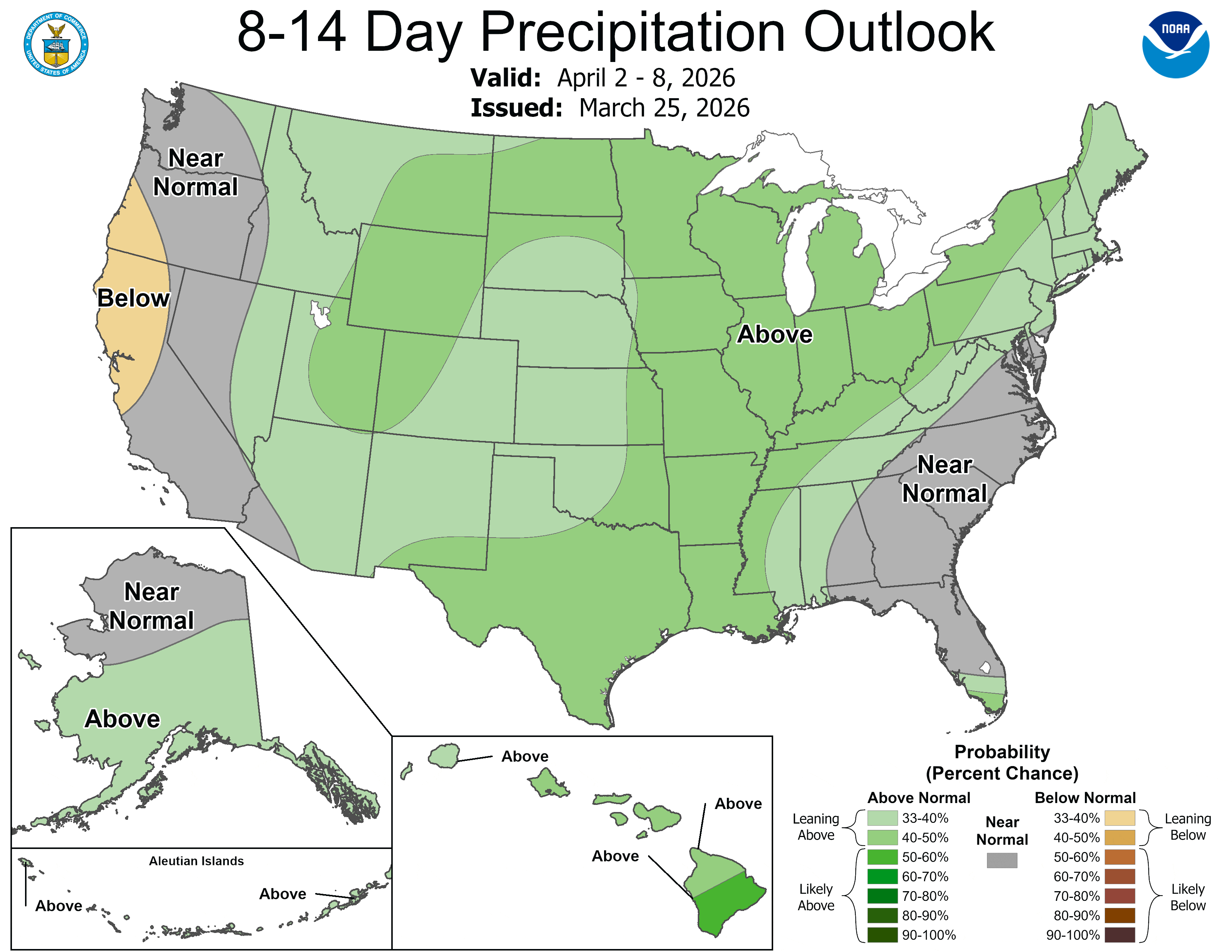
The latest from the Climate Prediction Center does at least show us with a good chance for normal precipitation as we move into April. While this won’t ease the deficits, it should help ease short-term effects. As plants and trees begin to grow and pull moisture out of the ground, sensible effects of the drought can quickly become more obvious as we move further into spring. Wildfire risk will also remain occasionally high depending on humidity and wind levels over the coming days.
Hopefully we will see some improvement soon, but for now stick with Now Georgia for the latest on the drought.


