

Over the past 24 hours things have become clearer in regards to our upcoming threats for wintry precipitation across North Georgia. We still have two separate timelines to watch, with an addition of some light snow showers possible overnight Friday.
Friday night snow showers
Another cold front will move through North Georgia overnight Friday. The latest high resolution models show potential for a snow/rain mix across the mountains as this front moves through with additional light snow showers behind it. All indications are that this will be very similar to the Wednesday night event with left only a dusting at the highest elevations of the mountains.
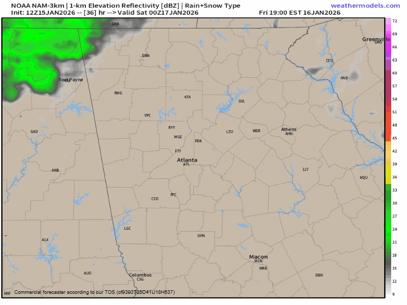
Forecast radar shows the frontal showers arriving around 7 p.m. on Friday night in the western part of the region pushing east through the evening. It will be cool enough by 1 a.m. across the mountains for this rain to change over to snow.
Unfortunately, the ground will be wet and with temperatures briefly above freezing it will take time for any snow to stick. Ultimately, another dusting is possible but as we saw Wednesday night it is not a guarantee unless you live in one of the few areas above 4,000ft. I can’t rule out some flurries continuing just a bit past sunrise on Saturday morning but for the most part it will just be windy and cold.
Saturday/Sunday weather
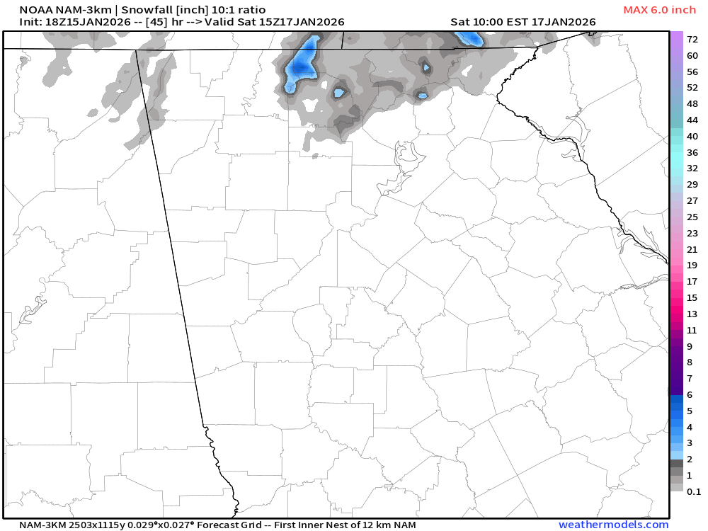
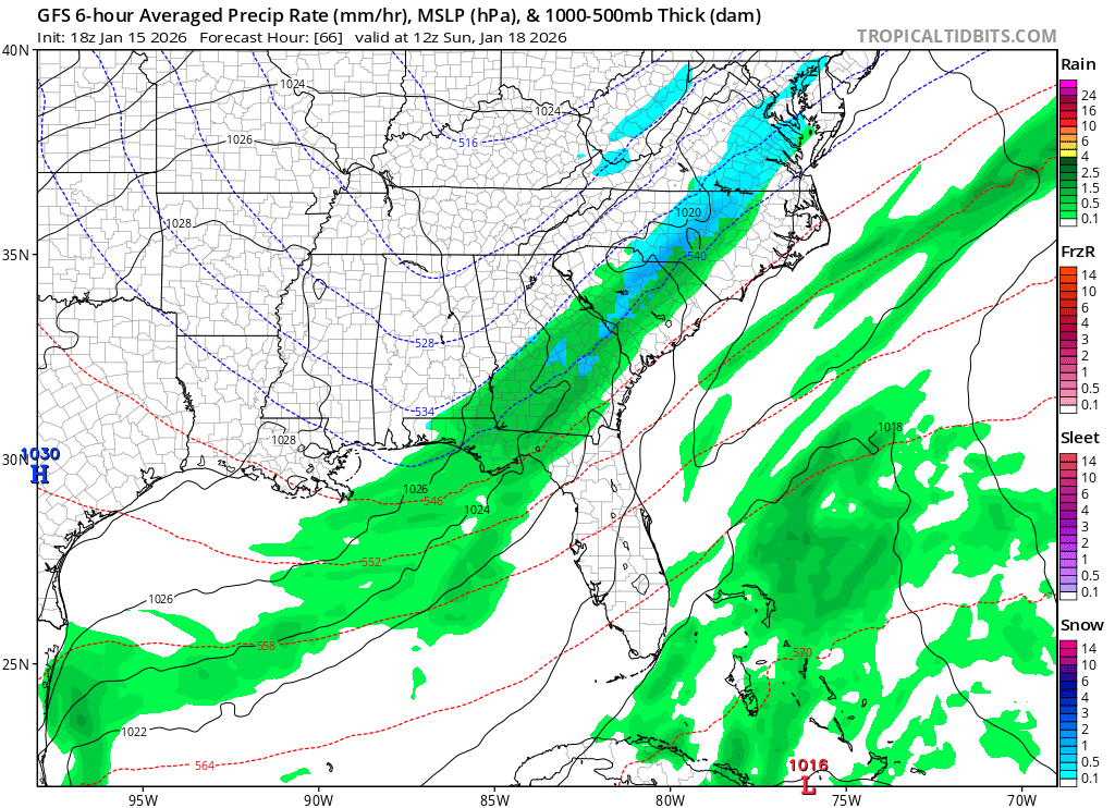
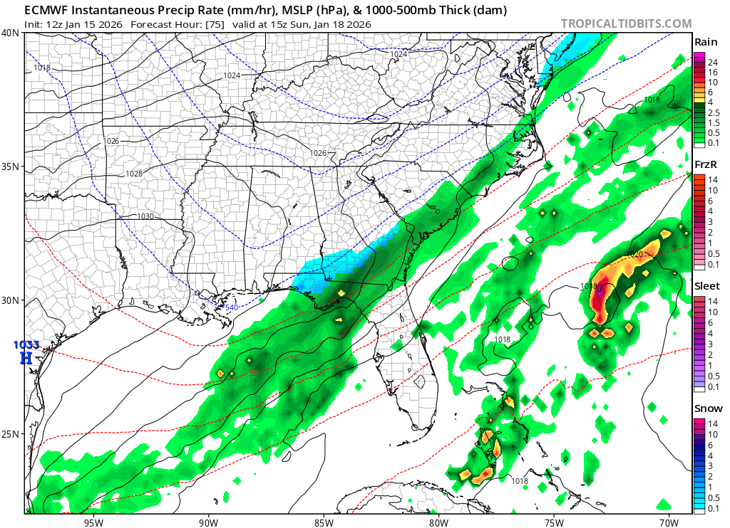
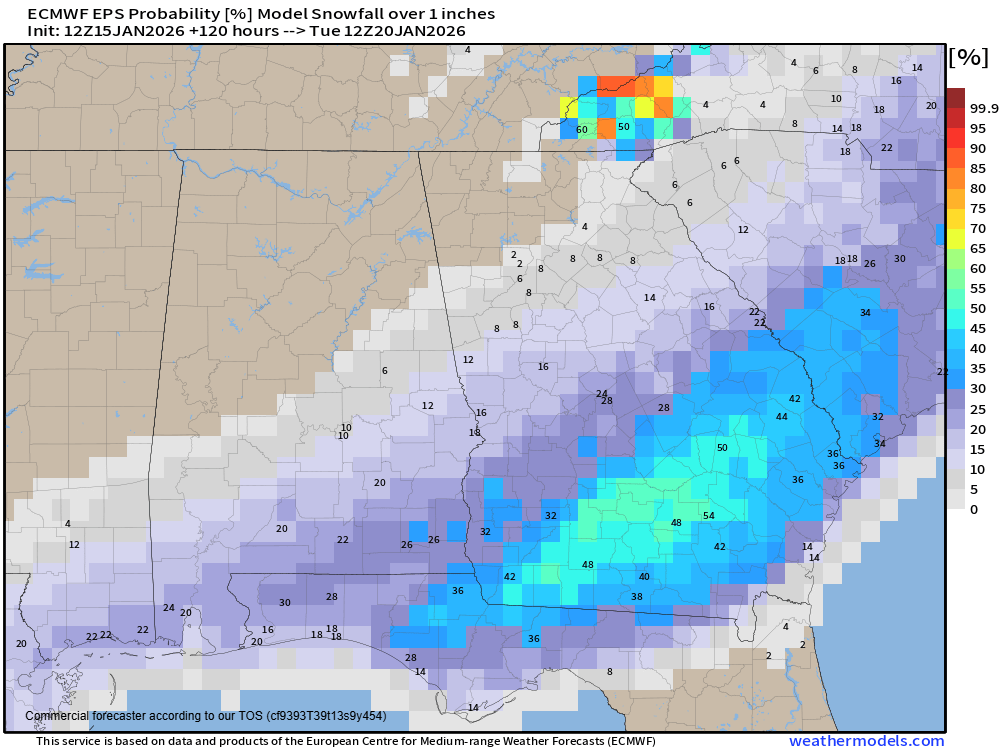
Models have really come into much better agreement on the next system due in on Saturday night into Sunday morning. Unfortunately for us across North Georgia, it has gone against us. As we suspected in last night’s story, the GFS model has come around significantly towards the much more reliable Euro solution. Both models now keep most, if not all, of the snow south and east of the I-85 corridor. The Euro in particular has really dropped potential totals with very limited moisture making it inland at all. This system will be battling some dry air on its northwest side, which takes more moisture to overcome as well.
The ensembles (the individual forecasts that make up each model) really help paint the picture, with only a small fraction of both models showing any meaningful snowfall.
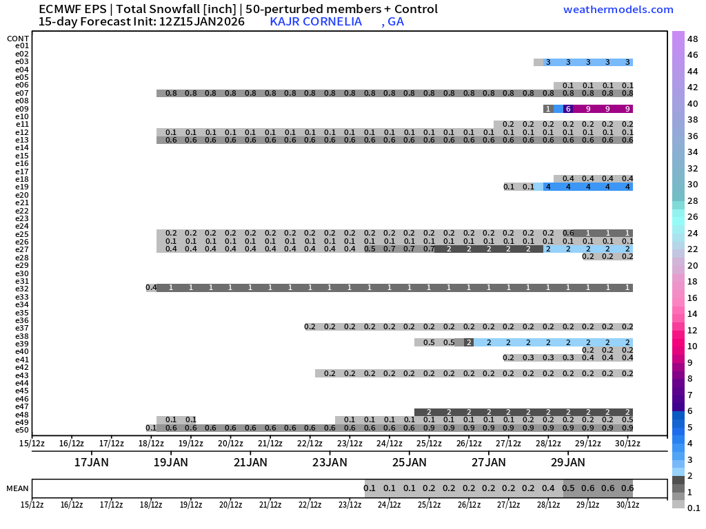
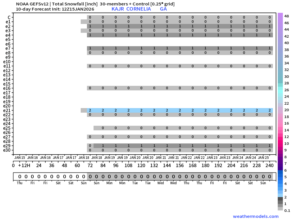
The chances remain better over central and south Georgia where there is still a 40-50% chance of over 1″ of snow.
Maybe, but probably not
Unfortunately, this system appears all but lost for us here in North Georgia, if it was ever really “found” to begin with.
As you are perusing social media this time of year remember not to confuse detail with accuracy or “professional” with reliability. Far too many people fall victim to the clickbait weather pictures and “forecasts” this time of year, and wind up very disappointed. Snow in the southeast is very hard to get and it doesn’t look likely right now. There is still time for change, and last minute shifts northwest of precipitation happens all the time with these coastal systems, but at the end of the day I am not optimistic for anything to fall north/west of the I-85 corridor, with only limited chances for a dusting anywhere north of I-20.


