

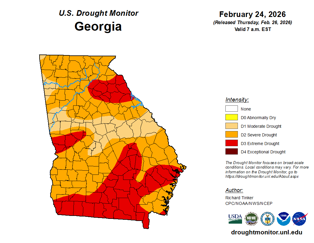
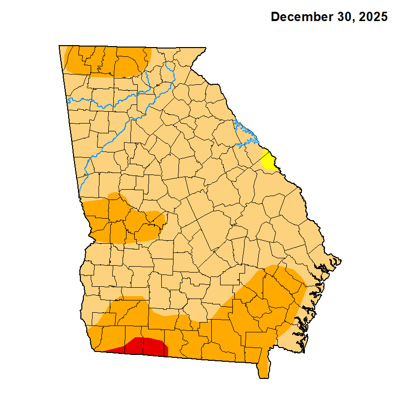
A severe drought continues to worsen across Georgia as generally dry weather has prevailed over the past few weeks.
We have some good rainfall falling across parts of the state on Thursday. While this will help temporarily, totals won’t be enough to put a huge dent in the current drought that dates back several months. The latest from the US Drought Monitor shows the entire state in at least a moderate drought. 85% of the state is in a severe drought and 33% of the state is in an extreme drought.
Where we’ve been
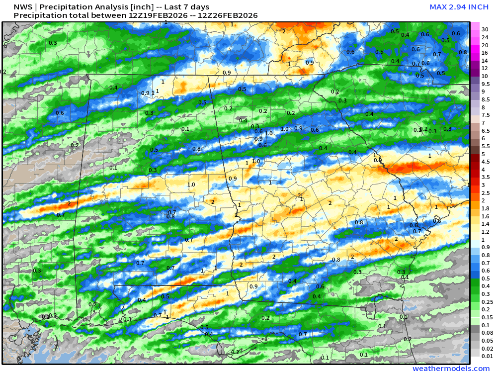
While we have had occasional rainfall across the state for the past few weeks, and we’ve even seen some good rainfall totals in spots over the past 7 days. Below is he 7 day rainfall totals from the National Weather Service. The best spots have been south of I-20 and along the TN/NC border where 1-2″ has fallen. A large swath of north and extreme south Georgia saw very disappointing totals of less than 1/2″.
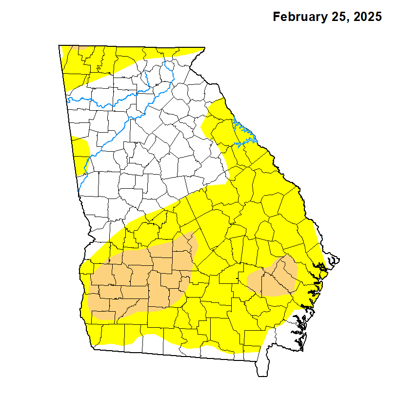
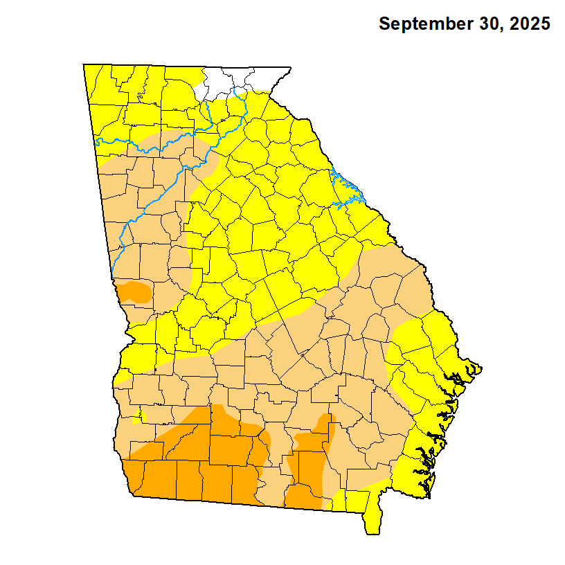
The progression of the drought over the past year can be easily seen below. Back in February of 2025 we were fresh off the dry fall following Hurricane Helene, but very little of the state was in any kind of significant drought. Then, by September the drought was creeping north with almost all of the state in at least abnormally dry conditions. The drought worsened through December and has continued to do so through early 2026.
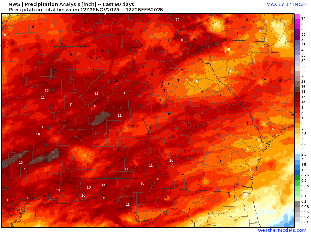
Looking at the past 3 months, rainfall totals aren’t awful, but they are well below averages. We’ve seen generally 7-10″ across the state, although parts of southeast and northeast Georgia both have seen 6″ or less.
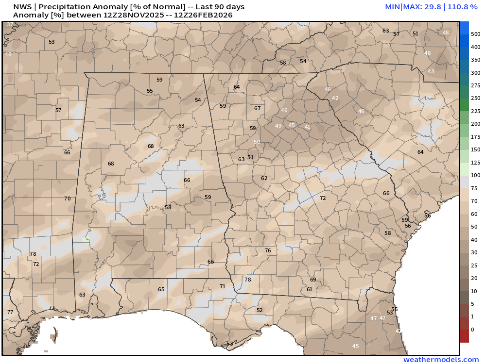
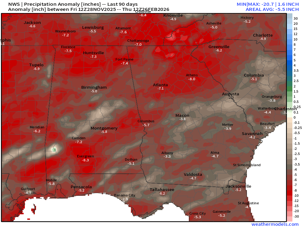
Rainfall deficits remain very concerning. The 3 month percentage of normal and departure from normal can be seen below. Deficits range from just 3.3″ in Albany to over 7.1″ in Atlanta and 8.0″ in Athens. These deficits have resulted in very dry soil which has led to many increased fire danger days across the entire state.
Where we’re going
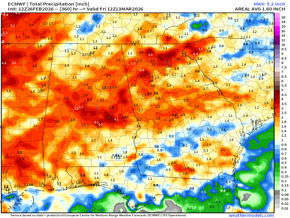
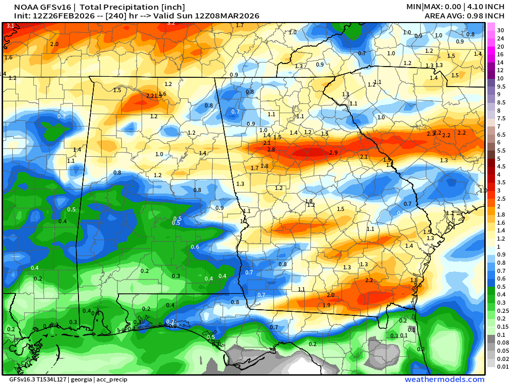
Unfortunately, the upcoming weather pattern is not promising for any significant rainfall. The current system is expected to bring a widespread 1-2″ of rain across the central and southern parts of the state, but beyond that it does appear we will stay mainly dry with a significantly warmer airmass moving in. The Euro 15-day forecast and the GFS 10-day forecast are both below, but keep in mind these also include the current weather system. The Euro solution is much more optimistic for rain across North Georgia, while the GFS is more optimistic for South Georgia.
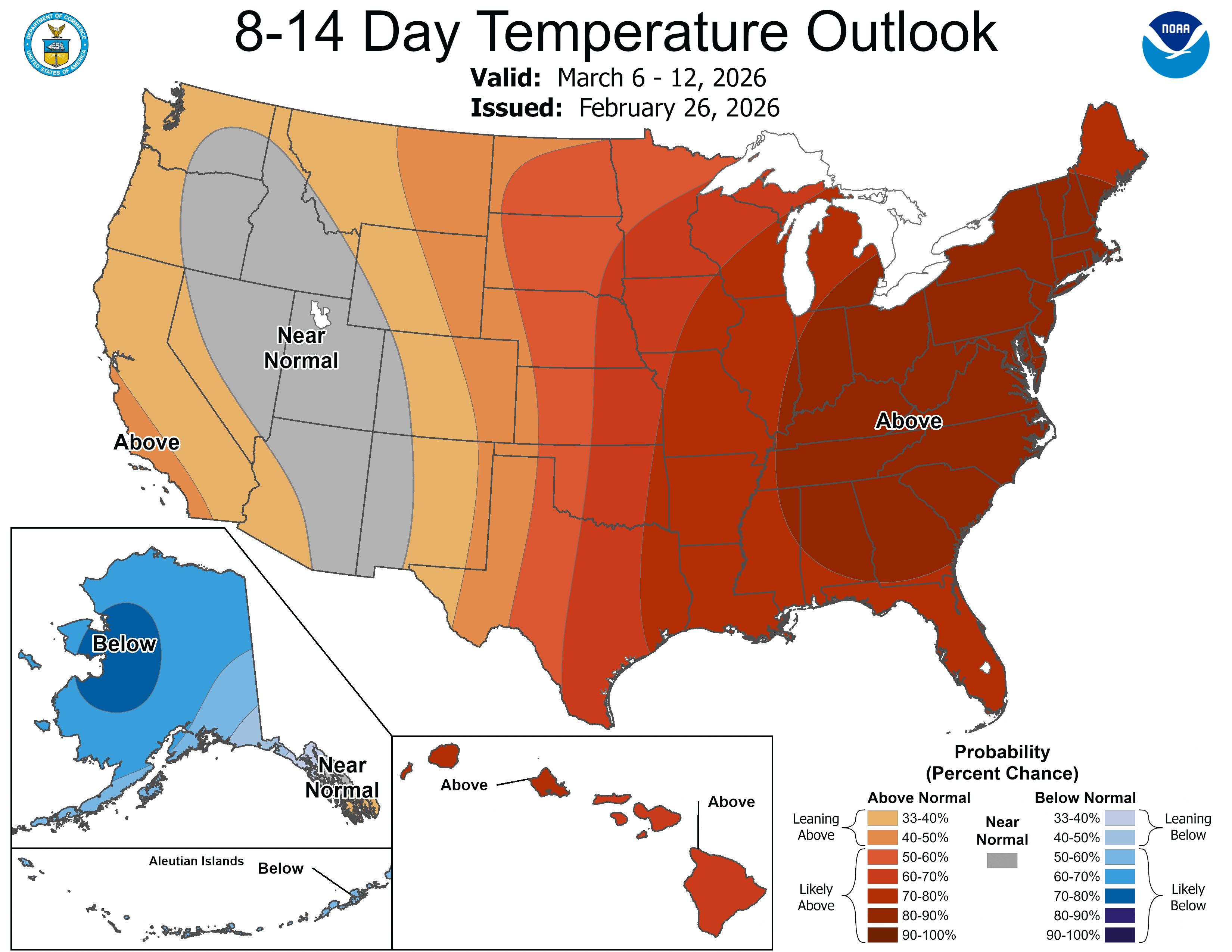
One thing is for certain, we’ll be seeing a significantly above average airmass moving in once again across the entire region. The 8-14 day temperature outlook paints a picture of very warm air with a 90% chance of above average. Most modeling pushes the region well above average this weekend, with a break on Mon/Tue thanks to a wedge of cooler air followed by a long run of 70-80+º weather.
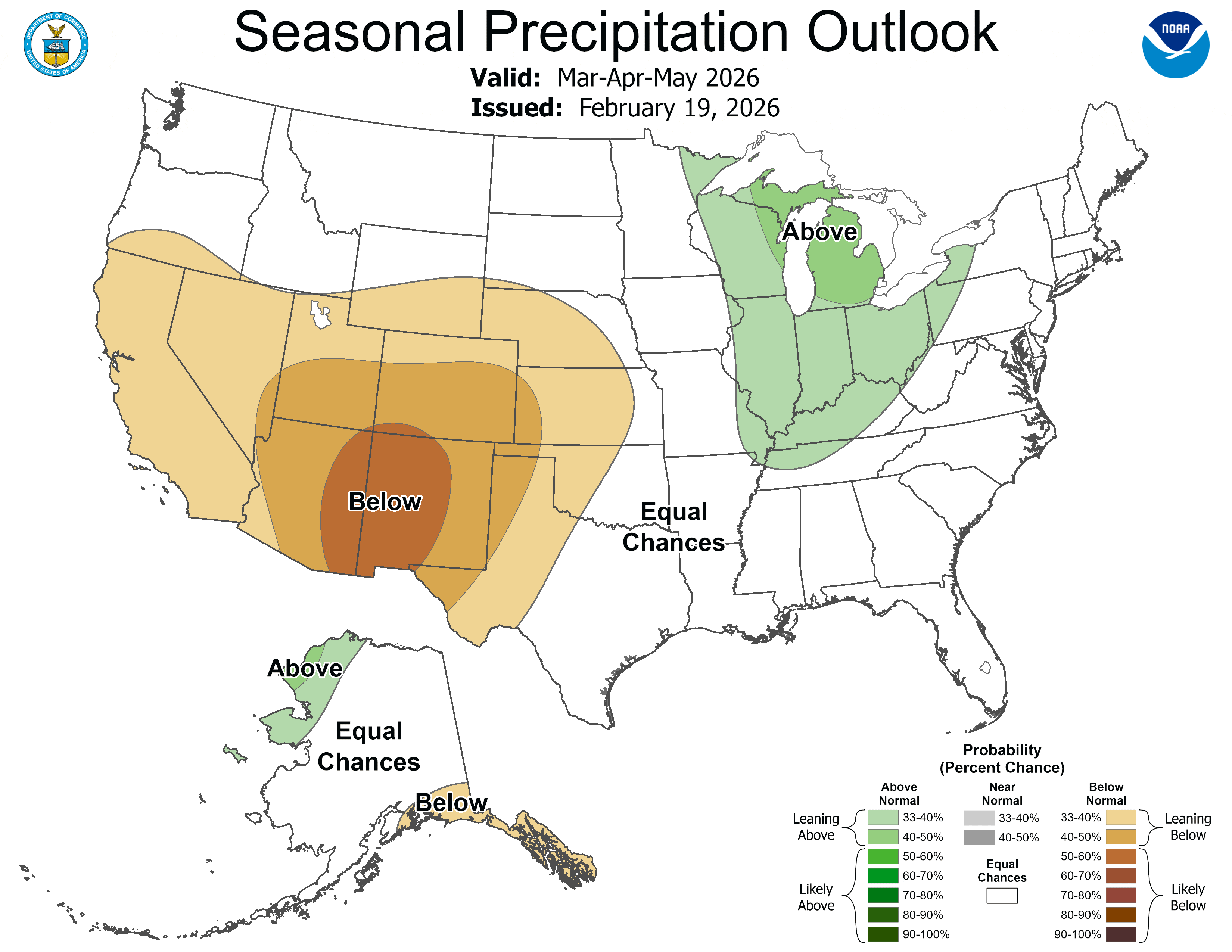
Looking even further ahead, the Climate Prediction Center gives us equal chances for above or below average precipitation over the next 3 months.
Ultimately, the current drought is likely to continue to stay the same or worsen over the coming months. Keep a close eye on fire danger statements as soil moisture remains low.
Stick with Now Georgia for all the latest on both the drought and any upcoming major weather systems.


