

People of all ages and races gathered inside the Regional African American Museum for an intergenerational memory-mapping workshop that turned Martin Luther King Jr. Day into a working history lesson.
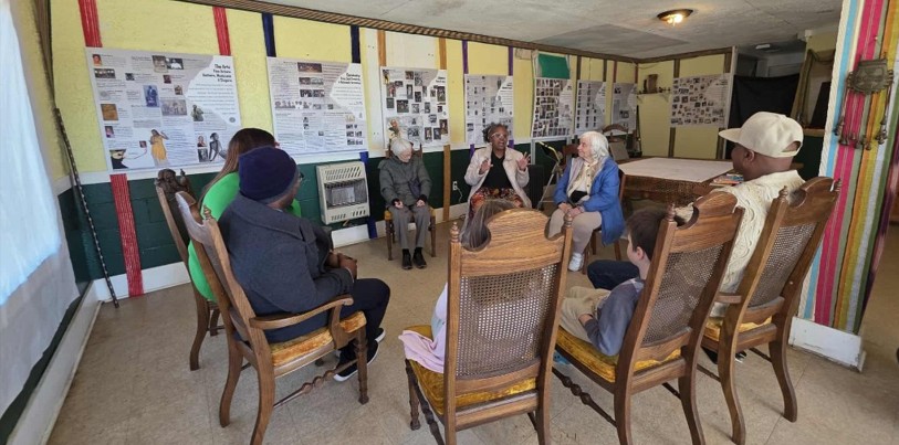
(Carly McCurry / Now Habersham)
An intergenerational gathering
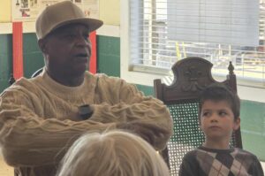
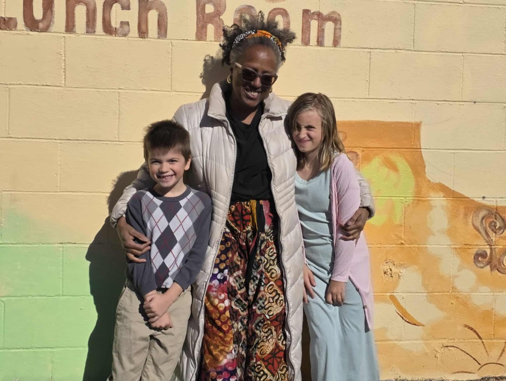
Upon arrival, Audrey Davenport welcomed attendees and took particular joy in greeting two children in the group, Jonah Tilley and his sister Lacey, students at Cornelia Elementary who chose the workshop over a trampoline and television at home, spending the holiday learning the history of their own community.
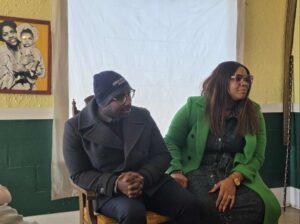
Participants formed a loose circle of mismatched chairs—wooden frames with velvet seats, patterned cushions worn smooth—familiar to anyone raised in Southern homes, city or rural. Introductions moved across generations, from longtime residents to newcomers, including Shady Grove Baptist Church pastor Sherrod Aiken and his wife, Jalessa Aiken.
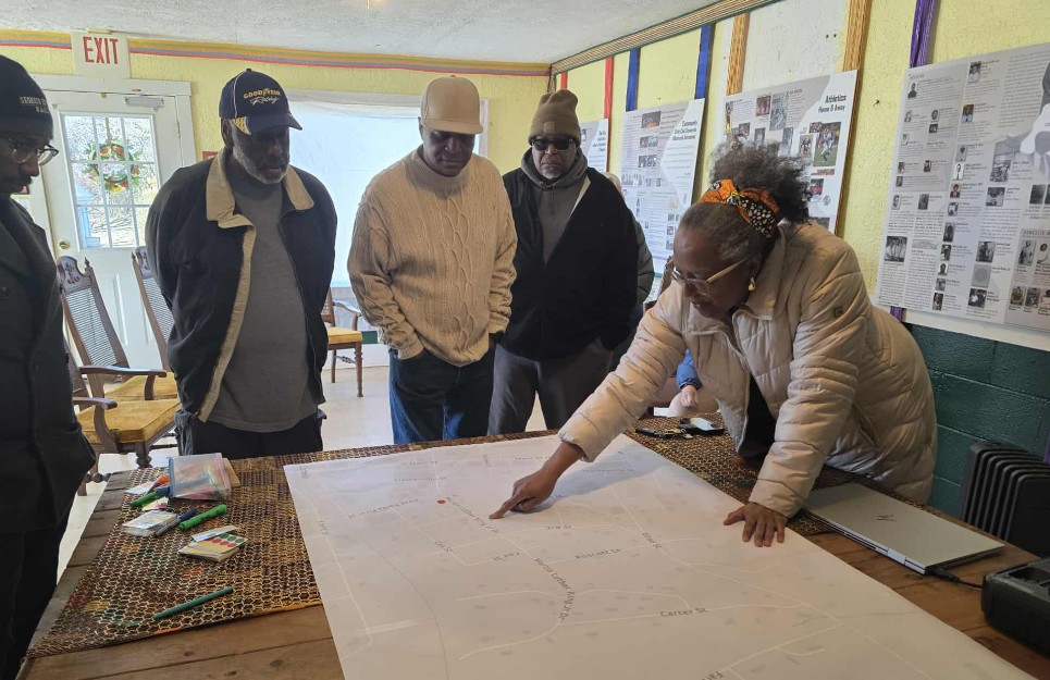
The group then gathered around a large map of the historically Black neighborhood, trading memories like baseball cards: where the plum bushes grew thickest, where a footpath cut through the woods, where the pool once stood, which yards swallowed lost balls, and which offered safe passage into a thinly wooded glade where children challenged blue jays for blackberries. Those memories will guide what is painted and how the community is represented in a series of murals planned for the fence at Jim Smith Park, a project supported in part by a Vibrant Communities grant from the Georgia Council for the Arts.
Memories abound as conversation flows.
(Carly McCurry / Now Habersham)
The neighborhood rises and dips in gentle grades, a series of rolling streets shaped by the logic of a railroad town. A handful of blocks stretch outward from the tracks in Cornelia, where industry and agriculture once shared the same narrow geography. Homes stood near work. Churches sat within walking distance of schools. A café, a pool, and a small commercial spine anchored daily life.
This was Cornelia’s Black community, formed by necessity and sustained by proximity. It extended across only a few streets, but it held a wide range of lives. Professors lived alongside orchard laborers. Railroad men raised children who became principals and nurses. Artists, café owners, and farm workers moved through the same spaces, shared the same routes, and attended the same schools.
Memory Mapping the Historically Black District of Cornelia
Residents spoke of “The Hill” and “Across the Ditch,” terms that described both geography and experience. The Hill held institutions—Shady Grove Baptist Church, Mrs. Sally’s Lunchroom, and The Community House. Across the Ditch sat lower, separated by a footbridge and a body of water that once marked an invisible boundary, which led to a more residential area. Across the Ditch ran behind Carter Street and stopped short of Farlinger Street, stretching toward the road to Mt. Airy.
Those gathered marked the map with markers, noting who lived where. Mrs. Jones’s house. Aunt Josie, who baked cakes. Mrs. Molly, who hosted Easter egg hunts. One participant, born in 1963, recalled the community swimming pool. Others noted that Across the Ditch carried a negative reputation at the time, one that did not reflect how residents understood their own community. One participant said it had “always been separated,” even as daily life contradicted that idea. Kids played together. Teams competed across informal lines. Families attended the same schools and churches.
(Carly McCurry / Now Habersham)
As the conversation progressed, Tony Cook, the Ward 4 commissioner, summed up the discussion: “We all have to realize that we all are the Hill.” The statement reframed the map not as opposing sections but as a single neighborhood shaped by access, memory, and shared labor.
That history matters because change now presses against it. When development arrives in small Southern towns, it often moves first through Black neighborhoods. Property values shift. Familiar landmarks disappear. Names fall out of use. The physical markers of community give way to new uses that rarely reflect the people who built the place.
The conversation turned repeatedly to Martin Luther King streets and what they represent.
Across the country, Dr. King streets often stop short—renamed only through historically Black sections, rarely extended into white neighborhoods. Speakers described this pattern as a form of symbolic segregation. King’s name appears, but the geography remains divided. Integration exists in language, as in planning.
Prioritizing Preservation
In Cornelia, that pattern carries real weight. The renaming of streets reflects resistance as much as recognition. Participants described how sections of roads changed names to avoid association with Black residents. The result left King’s name attached to only part of a street, reinforcing boundaries rather than removing them.
To counter erasure, residents pointed to documentation. Digitize Habersham preserves newspapers, school records, photographs, and articles that record Black life in the county. Speakers cited finding family names, graduation lists, and stories that confirmed what memories they already held. The archive provides evidence when physical landmarks disappear.
Poetry surfaced as another record. Soque Street Poems by Dr. Doris Davenport named families, streets, and shared histories. Participants described it as a map made of words.
As the discussion unfolded, the neighborhood emerged as a place shaped by many experiences rather than a single narrative. Just northwest of Cornelia, it functioned as a working community formed by land, labor, and movement. It produced educators and railroad workers, farmers and artists, people who lived close enough to know one another’s routines.
As Cornelia grows, those routines risk being overwritten. The anecdotes shared—about footbridges, Easter egg hunts, plum trees, and pools—serve not as simply nostalgia but as evidence. They explain how the neighborhood worked and why it mattered. They also explain what stands to be lost when development proceeds without memory.
The map on the table did more than locate streets. It restored names to places and people to geography. In doing so, it argued that this community was never marginal. It was central, connected, and fully formed—long before anyone thought to redraw it.
The next community conversation on Brushstrokes of Change: Public Art for Rural Revival will take place at Cornelia City Hall at 5:30 p.m., led by Audrey Davenport in collaboration with the City of Cornelia, to review the outcomes of the January 19 memory-mapping session and discuss next steps.


